Huangben geodata
Huangben (Guangdong) is a seat of a fourth-order administrative division; located in China in Asia/Shanghai (GMT+8) time zone. In our database, there are 1268 cities with bigger population. Compared to other cities in China, 87.6% of cities are located further ↑North; 59.2% of cities are located further →East and 61.7% of cities have higher elevation than Huangben. Note1


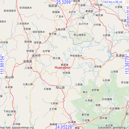
Huangben GPS coordinates[2]
24° 41' 33.792" North, 112° 41' 4.776" East
| Map corner | latitude | longitude |
|---|---|---|
| Upper-left | 25.3299°, | 111.98154° |
| Center: | 24.69272°, | 112.68466° |
| Lower-right: | 24.05226°, | 113.38779° |
| Map W x H: | 142.1×142.1 km | = 88.3×88.3mi |
| max Lat: | 53.31946° ⇑87.6% North |
| Huangben: | 24.69272° |
| min Lat: | ⇓12.4% South 18.22056° |
| min Long | Huangben | max Long |
| 75.07348° | 112.68466° | 134.28917° |
| W 40.8%⇐ | ⇒59.2% E |
Elevation
Elevation of Huangben is 89 m = 292 ft, and this is 395.8 m = 1299 ft below average elevation for this country.
| Max E: |
5622 m = 18445 ft | 61.7% |
| Avg. | 484.8 m = 1591 ft | |
| Huangben | 89 m = 292 ft | |
Min E: |
-3 m = -10 ft | 38.3% |
See also: China elevation on elevation.city.
Geographical zone
Huangben is located in North temperate zone (between Tropic of Cancer and the Arctic Circle). Distance of this Northern Tropic circle is 139.7 km =86.8 mi to South.| Distance of | km | miles | from Huangben |
|---|---|---|---|
| North Pole | 7261.5 | 4512.1 | to North |
| Arctic Circle | 4655.6 | 2892.9 | to North |
| Tropic Cancer | 139.7 | 86.8 | to South |
| Equator | 2745.6 | 1706 | to South |


Nearby cities:
15 places around Huangben: (largest is in red/bold)
• Chengjia
14.4 km =8.9 mi,  53°
53°
• Dalang
33.6 km =20.9 mi,  216°
216°
• Jiangying
26.7 km =16.6 mi,  144°
144°
• Jiubei
32.3 km =20.1 mi,  265°
265°
• Lianzhou
33.2 km =20.6 mi,  287°
287°
• Libu
30.9 km =19.2 mi,  240°
240°
• Lingbei
8.9 km =5.5 mi,  167°
167°
• Longping
25.3 km =15.7 mi,  304°
304°
• Luoyang
36.3 km =22.6 mi,  92°
92°
• Qingkeng
37.7 km =23.4 mi, 143°
• Qinglian
26.4 km =16.4 mi,  164°
164°
• Xiaojiang
12.5 km =7.8 mi,  226°
226°
• Xijiang
12.3 km =7.6 mi, 304°
• Xingzi
36.8 km =22.9 mi,  338°
338°
• Yangcheng
24.1 km =15 mi,  190°
190°
Sources, notices
• [Note1] Compared only with cities in China existing in our database
• [Src1] Map data: © OpenStreetMap contributors (CC-BY-SA)
• [Src2] Other city data from geonames.org with taken over terms of usage.
• [Src3] Geographical zone / Annual Mean Temperature by Robert A. Rohde @ Wikipedia
