Xiaojiang geodata
Xiaojiang (Guangdong) is a seat of a fourth-order administrative division; located in China in Asia/Shanghai (GMT+8) time zone. In our database, there are 1268 cities with bigger population. Compared to other cities in China, 88% of cities are located further ↑North; 59.5% of cities are located further →East and 64.8% of cities have higher elevation than Xiaojiang. Note1


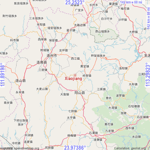
Xiaojiang GPS coordinates[2]
24° 36' 52.956" North, 112° 35' 42.36" East
| Map corner | latitude | longitude |
|---|---|---|
| Upper-left | 25.2523°, | 111.89198° |
| Center: | 24.61471°, | 112.5951° |
| Lower-right: | 23.97386°, | 113.29823° |
| Map W x H: | 142.1×142.2 km | = 88.3×88.4mi |
| max Lat: | 53.31946° ⇑88% North |
| Xiaojiang: | 24.61471° |
| min Lat: | ⇓12% South 18.22056° |
| min Long | Xiaojiang | max Long |
| 75.07348° | 112.5951° | 134.28917° |
| W 40.5%⇐ | ⇒59.5% E |
Elevation
Elevation of Xiaojiang is 74 m = 243 ft, and this is 410.8 m = 1348 ft below average elevation for this country.
| Max E: |
5622 m = 18445 ft | 64.8% |
| Avg. | 484.8 m = 1591 ft | |
| Xiaojiang | 74 m = 243 ft | |
Min E: |
-3 m = -10 ft | 35.2% |
See also: China elevation on elevation.city.
Geographical zone
Xiaojiang is located in North temperate zone (between Tropic of Cancer and the Arctic Circle). Distance of this Northern Tropic circle is 131 km =81.4 mi to South.| Distance of | km | miles | from Xiaojiang |
|---|---|---|---|
| North Pole | 7270.2 | 4517.5 | to North |
| Arctic Circle | 4664.3 | 2898.3 | to North |
| Tropic Cancer | 131 | 81.4 | to South |
| Equator | 2736.9 | 1700.6 | to South |


Nearby cities:
15 places around Xiaojiang: (largest is in red/bold)
• Chengjia
26.9 km =16.7 mi,  50°
50°
• Dalang
21.4 km =13.3 mi,  210°
210°
• Dubu
32.1 km =19.9 mi,  166°
166°
• Huangben
12.5 km =7.8 mi, 46°
• Jiangying
27.9 km =17.3 mi,  117°
117°
• Jiubei
23.9 km =14.9 mi,  284°
284°
• Lianzhou
29.3 km =18.2 mi,  309°
309°
• Libu
19 km =11.8 mi,  250°
250°
• Lingbei
10.9 km =6.8 mi,  90°
90°
• Longping
25.8 km =16 mi,  332°
332°
• Qinglian
23.3 km =14.5 mi,  135°
135°
• Sanpai
31.8 km =19.8 mi, 278°
• Xijiang
15.6 km =9.7 mi,  355°
355°
• Yangcheng
15.8 km =9.8 mi,  162°
162°
• Zhaigang
27.7 km =17.2 mi, 245°
Sources, notices
• [Note1] Compared only with cities in China existing in our database
• [Src1] Map data: © OpenStreetMap contributors (CC-BY-SA)
• [Src2] Other city data from geonames.org with taken over terms of usage.
• [Src3] Geographical zone / Annual Mean Temperature by Robert A. Rohde @ Wikipedia
