Xinguan geodata
Xinguan (Shanxi) is a seat of a third-order administrative division; located in China in Asia/Shanghai (GMT+8) time zone. In our database, there are 1268 cities with bigger population. Compared to other cities in China, 84.5% of cities are located further ↓South; 64.9% of cities are located further →East and 88.9% of cities have lower elevation than Xinguan. Note1


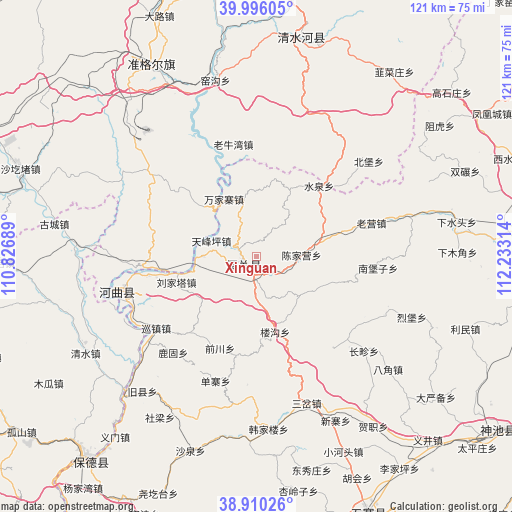
Xinguan GPS coordinates[2]
39° 27' 18.972" North, 111° 31' 48.036" East
| Map corner | latitude | longitude |
|---|---|---|
| Upper-left | 39.99605°, | 110.82689° |
| Center: | 39.45527°, | 111.53001° |
| Lower-right: | 38.91026°, | 112.23314° |
| Map W x H: | 120.7×120.7 km | = 75×75mi |
| max Lat: | 53.31946° ⇑15.5% North |
| Xinguan: | 39.45527° |
| min Lat: | ⇓84.5% South 18.22056° |
| min Long | Xinguan | max Long |
| 75.07348° | 111.53001° | 134.28917° |
| W 35.1%⇐ | ⇒64.9% E |
Elevation
Elevation of Xinguan is 1261 m = 4137 ft, and this is 776.2 m = 2547 ft above average elevation for this country.
| Max E: |
5622 m = 18445 ft | 11.1% |
| Xinguan | 1261 m 4137 ft | |
| Avg. | 484.8 m = 1591 ft | |
Min E: |
-3 m = -10 ft | 88.9% |
See also: China elevation on elevation.city.
Geographical zone
Xinguan is located in North temperate zone (between Tropic of Cancer and the Arctic Circle). Distance of this Northern Tropic circle is 1781.1 km =1106.7 mi to South.| Distance of | km | miles | from Xinguan |
|---|---|---|---|
| North Pole | 5620 | 3492.1 | to North |
| Arctic Circle | 3014.2 | 1872.9 | to North |
| Tropic Cancer | 1781.1 | 1106.7 | to South |
| Equator | 4387 | 2726 | to South |


Nearby cities:
15 places around Xinguan: (largest is in red/bold)
• Bajiao
41 km =25.5 mi,  130°
130°
• Beibao
34.1 km =21.2 mi,  50°
50°
• Changzhen
33.8 km =21 mi, 131°
• Chengguan
51.7 km =32.1 mi,  13°
13°
• Dongmugou
44.9 km =27.9 mi,  354°
354°
• Hezhi
48.8 km =30.3 mi,  145°
145°
• Liebu
39.3 km =24.4 mi,  111°
111°
• Nuanquan
32.1 km =19.9 mi,  32°
32°
• Shantaizi
26.4 km =16.4 mi, 346°
• Wenbi
30.1 km =18.7 mi,  255°
255°
• Xiamujiao
47.3 km =29.4 mi,  88°
88°
• Xiaomiaozi
52.5 km =32.6 mi, 11°
• Xiashuitou
48 km =29.8 mi,  80°
80°
• Yaogou
40.8 km =25.4 mi, 348°
• Zuhu
52.8 km =32.8 mi, 54°
Sources, notices
• [Note1] Compared only with cities in China existing in our database
• [Src1] Map data: © OpenStreetMap contributors (CC-BY-SA)
• [Src2] Other city data from geonames.org with taken over terms of usage.
• [Src3] Geographical zone / Annual Mean Temperature by Robert A. Rohde @ Wikipedia
