Changhua geodata
Changhua (Zhejiang) is a seat of a fourth-order administrative division; located in China in Asia/Shanghai (GMT+8) time zone. In our database, there are 1268 cities with bigger population. Compared to other cities in China, 52.4% of cities are located further ↑North; 77.1% of cities are located further ←West and 55.9% of cities have higher elevation than Changhua. Note1


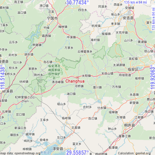
Changhua GPS coordinates[2]
30° 10' 5.988" North, 119° 13' 3" East
| Map corner | latitude | longitude |
|---|---|---|
| Upper-left | 30.77434°, | 118.51438° |
| Center: | 30.16833°, | 119.2175° |
| Lower-right: | 29.55857°, | 119.92063° |
| Map W x H: | 135.2×135.2 km | = 84×84mi |
| max Lat: | 53.31946° ⇑52.4% North |
| Changhua: | 30.16833° |
| min Lat: | ⇓47.6% South 18.22056° |
| min Long | Changhua | max Long |
| 75.07348° | 119.2175° | 134.28917° |
| W 77.1%⇐ | ⇒22.9% E |
Elevation
Elevation of Changhua is 125 m = 410 ft, and this is 359.8 m = 1180 ft below average elevation for this country.
| Max E: |
5622 m = 18445 ft | 55.9% |
| Avg. | 484.8 m = 1591 ft | |
| Changhua | 125 m = 410 ft | |
Min E: |
-3 m = -10 ft | 44.1% |
See also: China elevation on elevation.city.
Geographical zone
Changhua is located in North temperate zone (between Tropic of Cancer and the Arctic Circle). Distance of this Northern Tropic circle is 748.5 km =465.1 mi to South.| Distance of | km | miles | from Changhua |
|---|---|---|---|
| North Pole | 6652.7 | 4133.8 | to North |
| Arctic Circle | 4046.8 | 2514.6 | to North |
| Tropic Cancer | 748.5 | 465.1 | to South |
| Equator | 3354.4 | 2084.3 | to South |


Nearby cities:
15 places around Changhua: (largest is in red/bold)
• Henglu
18.3 km =11.4 mi,  30°
30°
• Heqiao
7.3 km =4.5 mi,  170°
170°
• Leping
24.6 km =15.3 mi,  135°
135°
• Longgang
9.1 km =5.7 mi,  265°
265°
• Maxiao
24.5 km =15.2 mi,  264°
264°
• Qianchuan
18.7 km =11.6 mi,  117°
117°
• Qianhong
20 km =12.4 mi,  59°
59°
• Qingliangfeng
18.5 km =11.5 mi, 259°
• Taiyang
7.8 km =4.8 mi,  76°
76°
• Tuankou
15.4 km =9.6 mi,  203°
203°
• Yihe
26.7 km =16.6 mi,  150°
150°
• Yunti
23.7 km =14.7 mi,  15°
15°
• Yuqian
17 km =10.6 mi, 82°
• Yutiao
23.1 km =14.4 mi,  305°
305°
• Zaoxi
26.4 km =16.4 mi, 82°
Sources, notices
• [Note1] Compared only with cities in China existing in our database
• [Src1] Map data: © OpenStreetMap contributors (CC-BY-SA)
• [Src2] Other city data from geonames.org with taken over terms of usage.
• [Src3] Geographical zone / Annual Mean Temperature by Robert A. Rohde @ Wikipedia
