Yutiao geodata
Yutiao (Zhejiang) is a seat of a fourth-order administrative division; located in China in Asia/Shanghai (GMT+8) time zone. In our database, there are 1268 cities with bigger population. Compared to other cities in China, 51.3% of cities are located further ↑North; 76.2% of cities are located further ←West and 72.4% of cities have lower elevation than Yutiao. Note1


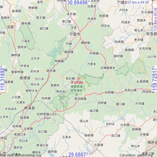
Yutiao GPS coordinates[2]
30° 17' 22.956" North, 119° 1' 19.344" East
| Map corner | latitude | longitude |
|---|---|---|
| Upper-left | 30.89496°, | 118.31892° |
| Center: | 30.28971°, | 119.02204° |
| Lower-right: | 29.6807°, | 119.72517° |
| Map W x H: | 135×135 km | = 83.9×83.9mi |
| max Lat: | 53.31946° ⇑51.3% North |
| Yutiao: | 30.28971° |
| min Lat: | ⇓48.7% South 18.22056° |
| min Long | Yutiao | max Long |
| 75.07348° | 119.02204° | 134.28917° |
| W 76.2%⇐ | ⇒23.8% E |
Elevation
Elevation of Yutiao is 461 m = 1512 ft, and this is 23.8 m = 78 ft below average elevation for this country.
| Max E: |
5622 m = 18445 ft | 27.6% |
| Avg. | 484.8 m = 1591 ft | |
| Yutiao | 461 m = 1512 ft | |
Min E: |
-3 m = -10 ft | 72.4% |
See also: China elevation on elevation.city.
Geographical zone
Yutiao is located in North temperate zone (between Tropic of Cancer and the Arctic Circle). Distance of this Northern Tropic circle is 762 km =473.5 mi to South.| Distance of | km | miles | from Yutiao |
|---|---|---|---|
| North Pole | 6639.2 | 4125.4 | to North |
| Arctic Circle | 4033.3 | 2506.2 | to North |
| Tropic Cancer | 762 | 473.5 | to South |
| Equator | 3367.9 | 2092.7 | to South |


Nearby cities:
15 places around Yutiao: (largest is in red/bold)
• Changhua
23.1 km =14.4 mi,  125°
125°
• Daoshi
7.1 km =4.4 mi,  272°
272°
• Honglong
23.3 km =14.5 mi,  355°
355°
• Hule
24.9 km =15.5 mi,  286°
286°
• Jialu
22.7 km =14.1 mi,  312°
312°
• Jiapeng
21.2 km =13.2 mi,  254°
254°
• Jingzhou
18.7 km =11.6 mi,  234°
234°
• Longgang
17.2 km =10.7 mi,  145°
145°
• Maxiao
16.7 km =10.4 mi,  199°
199°
• Ningdun
20.6 km =12.8 mi,  23°
23°
• Qingliangfeng
16.7 km =10.4 mi,  177°
177°
• Wanjia
16.6 km =10.3 mi,  39°
39°
• Xiaxi
24.9 km =15.5 mi,  340°
340°
• Xinqiao
9.7 km =6 mi,  243°
243°
• Zhujiaqiao
12.9 km =8 mi, 19°
Sources, notices
• [Note1] Compared only with cities in China existing in our database
• [Src1] Map data: © OpenStreetMap contributors (CC-BY-SA)
• [Src2] Other city data from geonames.org with taken over terms of usage.
• [Src3] Geographical zone / Annual Mean Temperature by Robert A. Rohde @ Wikipedia
