Xinggongxia geodata
Xinggongxia (Fujian) is a seat of a fourth-order administrative division; located in China in Asia/Shanghai (GMT+8) time zone. In our database, there are 1268 cities with bigger population. Compared to other cities in China, 81.9% of cities are located further ↑North; 64.6% of cities are located further ←West and 66.9% of cities have lower elevation than Xinggongxia. Note1


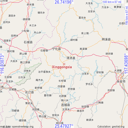
Xinggongxia GPS coordinates[2]
26° 6' 44.352" North, 116° 44' 1.86" East
| Map corner | latitude | longitude |
|---|---|---|
| Upper-left | 26.74196°, | 116.03073° |
| Center: | 26.11232°, | 116.73385° |
| Lower-right: | 25.47927°, | 117.43698° |
| Map W x H: | 140.4×140.4 km | = 87.2×87.2mi |
| max Lat: | 53.31946° ⇑81.9% North |
| Xinggongxia: | 26.11232° |
| min Lat: | ⇓18.1% South 18.22056° |
| min Long | Xinggongxia | max Long |
| 75.07348° | 116.73385° | 134.28917° |
| W 64.6%⇐ | ⇒35.4% E |
Elevation
Elevation of Xinggongxia is 357 m = 1171 ft, and this is 127.8 m = 419 ft below average elevation for this country.
| Max E: |
5622 m = 18445 ft | 33.1% |
| Avg. | 484.8 m = 1591 ft | |
| Xinggongxia | 357 m = 1171 ft | |
Min E: |
-3 m = -10 ft | 66.9% |
See also: China elevation on elevation.city.
Geographical zone
Xinggongxia is located in North temperate zone (between Tropic of Cancer and the Arctic Circle). Distance of this Northern Tropic circle is 297.5 km =184.9 mi to South.| Distance of | km | miles | from Xinggongxia |
|---|---|---|---|
| North Pole | 7103.6 | 4414 | to North |
| Arctic Circle | 4497.8 | 2794.8 | to North |
| Tropic Cancer | 297.5 | 184.9 | to South |
| Equator | 2903.4 | 1804.1 | to South |


Nearby cities:
15 places around Xinggongxia: (largest is in red/bold)
• Caofang
12.9 km =8 mi,  244°
244°
• Chengnan
11.7 km =7.3 mi,  350°
350°
• Cuijiang
18.8 km =11.7 mi,  333°
333°
• Dengjia
24.2 km =15 mi,  154°
154°
• Fangtian
20.9 km =13 mi,  292°
292°
• Laifang
24.7 km =15.3 mi,  142°
142°
• Litian
11.3 km =7 mi,  197°
197°
• Longjin
11.2 km =7 mi,  46°
46°
• Shawu
25.6 km =15.9 mi,  113°
113°
• Sibao
24.3 km =15.1 mi,  186°
186°
• Songkou
15.7 km =9.8 mi,  76°
76°
• Tianyuan
12.8 km =8 mi,  120°
120°
• Xianan
18.7 km =11.6 mi,  336°
336°
• Xiaoxi
18.1 km =11.2 mi, 186°
• Zhiping Shezu
23.1 km =14.4 mi,  249°
249°
Sources, notices
• [Note1] Compared only with cities in China existing in our database
• [Src1] Map data: © OpenStreetMap contributors (CC-BY-SA)
• [Src2] Other city data from geonames.org with taken over terms of usage.
• [Src3] Geographical zone / Annual Mean Temperature by Robert A. Rohde @ Wikipedia
