Zhongyuanlu geodata
Zhongyuanlu (Henan) is a seat of a third-order administrative division; located in China in Asia/Shanghai (GMT+8) time zone. In our database, there are 1268 cities with bigger population. Compared to other cities in China, 76.7% of cities are located further ↓South; 54.7% of cities are located further ←West and 69.7% of cities have higher elevation than Zhongyuanlu. Note1


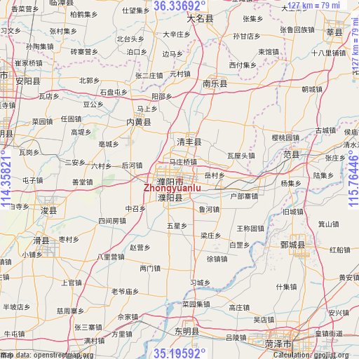
Zhongyuanlu GPS coordinates[2]
35° 46' 6.492" North, 115° 3' 40.788" East
| Map corner | latitude | longitude |
|---|---|---|
| Upper-left | 36.33692°, | 114.35821° |
| Center: | 35.76847°, | 115.06133° |
| Lower-right: | 35.19592°, | 115.76446° |
| Map W x H: | 126.9×126.9 km | = 78.9×78.9mi |
| max Lat: | 53.31946° ⇑23.3% North |
| Zhongyuanlu: | 35.76847° |
| min Lat: | ⇓76.7% South 18.22056° |
| min Long | Zhongyuanlu | max Long |
| 75.07348° | 115.06133° | 134.28917° |
| W 54.7%⇐ | ⇒45.3% E |
Elevation
Elevation of Zhongyuanlu is 53 m = 174 ft, and this is 431.8 m = 1417 ft below average elevation for this country.
| Max E: |
5622 m = 18445 ft | 69.7% |
| Avg. | 484.8 m = 1591 ft | |
| Zhongyuanlu | 53 m = 174 ft | |
Min E: |
-3 m = -10 ft | 30.3% |
See also: China elevation on elevation.city.
Geographical zone
Zhongyuanlu is located in North temperate zone (between Tropic of Cancer and the Arctic Circle). Distance of this Northern Tropic circle is 1371.2 km =852 mi to South.| Distance of | km | miles | from Zhongyuanlu |
|---|---|---|---|
| North Pole | 6030 | 3746.9 | to North |
| Arctic Circle | 3424.1 | 2127.6 | to North |
| Tropic Cancer | 1371.2 | 852 | to South |
| Equator | 3977.1 | 2471.3 | to South |


Nearby cities:
15 places around Zhongyuanlu: (largest is in red/bold)
• Chengguan
51.3 km =31.9 mi,  174°
174°
• Daming
58 km =36 mi,  7°
7°
• Daokou
55.1 km =34.2 mi,  245°
245°
• Dongming Chengguanzhen
53.1 km =33 mi,  177°
177°
• Fan Xian Chengguanzhen
40.8 km =25.4 mi,  75°
75°
• Juancheng
45.9 km =28.5 mi,  120°
120°
• Nanle Chengguanzhen
36.4 km =22.6 mi,  19°
19°
• Neihuang Chengguanzhen
24.8 km =15.4 mi,  324°
324°
• Puyang
4 km =2.5 mi,  261°
261°
• Puyang Chengguanzhen
8.2 km =5.1 mi,  211°
211°
• Qingfeng Chengguanzhen
15.5 km =9.6 mi, 14°
• Tangyang Chengguanzhen
65.7 km =40.8 mi,  284°
284°
• Xicheng
67.1 km =41.7 mi,  149°
149°
• Xun Xian Chengguanzhen
48.9 km =30.4 mi, 256°
• Yigou
67.3 km =41.8 mi,  274°
274°
Sources, notices
• [Note1] Compared only with cities in China existing in our database
• [Src1] Map data: © OpenStreetMap contributors (CC-BY-SA)
• [Src2] Other city data from geonames.org with taken over terms of usage.
• [Src3] Geographical zone / Annual Mean Temperature by Robert A. Rohde @ Wikipedia
