Yigou geodata
Yigou (Henan) is a populated place; located in China in Asia/Shanghai (GMT+8) time zone. With population of 59,073 people, there are 746 cities with bigger population in this country. Compared to other cities in China, 76.8% of cities are located further ↓South; 50.4% of cities are located further ←West and 61.5% of cities have higher elevation than Yigou. Note1


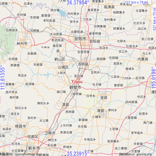
Yigou GPS coordinates[2]
35° 48' 41.004" North, 114° 19' 0.012" East
| Map corner | latitude | longitude |
|---|---|---|
| Upper-left | 36.37954°, | 113.61355° |
| Center: | 35.81139°, | 114.31667° |
| Lower-right: | 35.23915°, | 115.0198° |
| Map W x H: | 126.8×126.8 km | = 78.8×78.8mi |
| max Lat: | 53.31946° ⇑23.2% North |
| Yigou: | 35.81139° |
| min Lat: | ⇓76.8% South 18.22056° |
| min Long | Yigou | max Long |
| 75.07348° | 114.31667° | 134.28917° |
| W 50.4%⇐ | ⇒49.6% E |
Elevation
Elevation of Yigou is 90 m = 295 ft, and this is 394.8 m = 1295 ft below average elevation for this country.
| Max E: |
5622 m = 18445 ft | 61.5% |
| Avg. | 484.8 m = 1591 ft | |
| Yigou | 90 m = 295 ft | |
Min E: |
-3 m = -10 ft | 38.5% |
See also: Yigou elevation on elevation.city.
Geographical zone
Yigou is located in North temperate zone (between Tropic of Cancer and the Arctic Circle). Distance of this Northern Tropic circle is 1375.9 km =854.9 mi to South.| Distance of | km | miles | from Yigou |
|---|---|---|---|
| North Pole | 6025.2 | 3743.9 | to North |
| Arctic Circle | 3419.3 | 2124.7 | to North |
| Tropic Cancer | 1375.9 | 854.9 | to South |
| Equator | 3981.9 | 2474.2 | to South |


Nearby cities:
15 places around Yigou: (largest is in red/bold)
• Anyang
32.2 km =20 mi,  10°
10°
• Chaoge
25.7 km =16 mi,  206°
206°
• Chengguan
61.1 km =38 mi,  230°
230°
• Chengjiao
50.8 km =31.6 mi, 207°
• Daokou
32.4 km =20.1 mi,  148°
148°
• Hebi
14.8 km =9.2 mi,  311°
311°
• Kaiyuan
52.9 km =32.9 mi,  302°
302°
• Linshui
68.9 km =42.8 mi,  351°
351°
• Neihuang Chengguanzhen
55 km =34.2 mi,  73°
73°
• Pengcheng
70.2 km =43.6 mi, 349°
• Puyang
63.4 km =39.4 mi,  94°
94°
• Puyang Chengguanzhen
64 km =39.8 mi,  100°
100°
• Tangyang Chengguanzhen
12 km =7.5 mi,  16°
16°
• Xun Xian Chengguanzhen
25.5 km =15.8 mi,  129°
129°
• Zhongyuanlu
67.3 km =41.8 mi, 94°
Sources, notices
• [Note1] Compared only with cities in China existing in our database
• [Src1] Map data: © OpenStreetMap contributors (CC-BY-SA)
• [Src2] Other city data from geonames.org with taken over terms of usage.
• [Src3] Geographical zone / Annual Mean Temperature by Robert A. Rohde @ Wikipedia
