Yongfeng geodata
Yongfeng (Jiangxi) is a seat of a fourth-order administrative division; located in China in Asia/Shanghai (GMT+8) time zone. In our database, there are 1268 cities with bigger population. Compared to other cities in China, 81.2% of cities are located further ↑North; 55.4% of cities are located further ←West and 50.1% of cities have lower elevation than Yongfeng. Note1


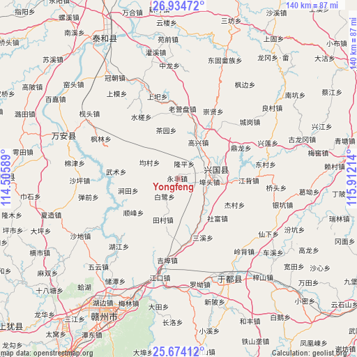
Yongfeng GPS coordinates[2]
26° 18' 22.068" North, 115° 12' 32.436" East
| Map corner | latitude | longitude |
|---|---|---|
| Upper-left | 26.93472°, | 114.50589° |
| Center: | 26.30613°, | 115.20901° |
| Lower-right: | 25.67412°, | 115.91214° |
| Map W x H: | 140.2×140.2 km | = 87.1×87.1mi |
| max Lat: | 53.31946° ⇑81.2% North |
| Yongfeng: | 26.30613° |
| min Lat: | ⇓18.8% South 18.22056° |
| min Long | Yongfeng | max Long |
| 75.07348° | 115.20901° | 134.28917° |
| W 55.4%⇐ | ⇒44.6% E |
Elevation
Elevation of Yongfeng is 166 m = 545 ft, and this is 318.8 m = 1046 ft below average elevation for this country.
| Max E: |
5622 m = 18445 ft | 49.9% |
| Avg. | 484.8 m = 1591 ft | |
| Yongfeng | 166 m = 545 ft | |
Min E: |
-3 m = -10 ft | 50.1% |
See also: China elevation on elevation.city.
Geographical zone
Yongfeng is located in North temperate zone (between Tropic of Cancer and the Arctic Circle). Distance of this Northern Tropic circle is 319 km =198.2 mi to South.| Distance of | km | miles | from Yongfeng |
|---|---|---|---|
| North Pole | 7082.1 | 4400.6 | to North |
| Arctic Circle | 4476.2 | 2781.4 | to North |
| Tropic Cancer | 319 | 198.2 | to South |
| Equator | 2925 | 1817.5 | to South |


Nearby cities:
15 places around Yongfeng: (largest is in red/bold)
• Bailu
9.3 km =5.8 mi,  221°
221°
• Baoshan
20.7 km =12.9 mi,  283°
283°
• Butou
12.9 km =8 mi,  97°
97°
• Changgang
17 km =10.6 mi,  67°
67°
• Chayuan
19.7 km =12.2 mi,  345°
345°
• Dinglong
27.3 km =17 mi,  63°
63°
• Gaoxing
15.9 km =9.9 mi,  27°
27°
• Jiangbei
27.3 km =17 mi,  91°
91°
• Jiantian
19.3 km =12 mi,  259°
259°
• Jiecun
24.7 km =15.3 mi,  113°
113°
• Longkou
16.2 km =10.1 mi,  145°
145°
• Longping
6.1 km =3.8 mi, 25°
• Sanxixiang
24.6 km =15.3 mi,  158°
158°
• Shefu
21.9 km =13.6 mi,  134°
134°
• Shunfeng
22.2 km =13.8 mi,  234°
234°
Sources, notices
• [Note1] Compared only with cities in China existing in our database
• [Src1] Map data: © OpenStreetMap contributors (CC-BY-SA)
• [Src2] Other city data from geonames.org with taken over terms of usage.
• [Src3] Geographical zone / Annual Mean Temperature by Robert A. Rohde @ Wikipedia
