Yuntan geodata
Yuntan (Guangdong) is a seat of a fourth-order administrative division; located in China in Asia/Urumqi (GMT+6) time zone. In our database, there are 1268 cities with bigger population. Compared to other cities in China, 97.4% of cities are located further ↑North; 66.4% of cities are located further →East and 66.8% of cities have higher elevation than Yuntan. Note1


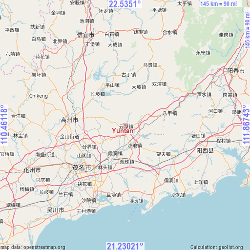
Yuntan GPS coordinates[2]
21° 53' 2.94" North, 111° 9' 51.48" East
| Map corner | latitude | longitude |
|---|---|---|
| Upper-left | 22.5351°, | 110.46118° |
| Center: | 21.88415°, | 111.1643° |
| Lower-right: | 21.23021°, | 111.86743° |
| Map W x H: | 145.1×145.1 km | = 90.2×90.2mi |
| max Lat: | 53.31946° ⇑97.4% North |
| Yuntan: | 21.88415° |
| min Lat: | ⇓2.6% South 18.22056° |
| min Long | Yuntan | max Long |
| 75.07348° | 111.1643° | 134.28917° |
| W 33.6%⇐ | ⇒66.4% E |
Elevation
Elevation of Yuntan is 65 m = 213 ft, and this is 419.8 m = 1377 ft below average elevation for this country.
| Max E: |
5622 m = 18445 ft | 66.8% |
| Avg. | 484.8 m = 1591 ft | |
| Yuntan | 65 m = 213 ft | |
Min E: |
-3 m = -10 ft | 33.2% |
See also: China elevation on elevation.city.
Geographical zone
Yuntan is located in North Torrid zone (between Equator and Tropic of Cancer). Distance of this Northern Tropic circle is 172.6 km =107.2 mi to North.| Distance of | km | miles | from Yuntan |
|---|---|---|---|
| North Pole | 7573.8 | 4706.1 | to North |
| Arctic Circle | 4967.9 | 3086.9 | to North |
| Tropic Cancer | 172.6 | 107.2 | to North |
| Equator | 2433.3 | 1512 | to South |


Nearby cities:
15 places around Yuntan: (largest is in red/bold)
• Caojiang
25.3 km =15.7 mi,  296°
296°
• Changpo
25.2 km =15.7 mi,  322°
322°
• Dapo
23.4 km =14.5 mi,  20°
20°
• Fenjie
24.2 km =15 mi,  239°
239°
• Genzi
15.9 km =9.9 mi,  233°
233°
• Guanzhu
21.5 km =13.4 mi,  177°
177°
• Huangling
5.6 km =3.5 mi,  190°
190°
• Luokeng
10.4 km =6.5 mi,  132°
132°
• Nahuo
7.7 km =4.8 mi,  84°
84°
• Pingshan
24.7 km =15.3 mi,  341°
341°
• Shalang
12.1 km =7.5 mi,  154°
154°
• Sishui
21.1 km =13.1 mi,  262°
262°
• Xiadong
17.7 km =11 mi,  198°
198°
• Xieji
19 km =11.8 mi,  280°
280°
• Xindong
10.8 km =6.7 mi, 284°
Sources, notices
• [Note1] Compared only with cities in China existing in our database
• [Src1] Map data: © OpenStreetMap contributors (CC-BY-SA)
• [Src2] Other city data from geonames.org with taken over terms of usage.
• [Src3] Geographical zone / Annual Mean Temperature by Robert A. Rohde @ Wikipedia
