Gaocun geodata
Gaocun (Guangdong) is a seat of a fourth-order administrative division; located in China in Asia/Shanghai (GMT+8) time zone. In our database, there are 1268 cities with bigger population. Compared to other cities in China, 94.8% of cities are located further ↑North; 63.2% of cities are located further →East and 66.4% of cities have higher elevation than Gaocun. Note1


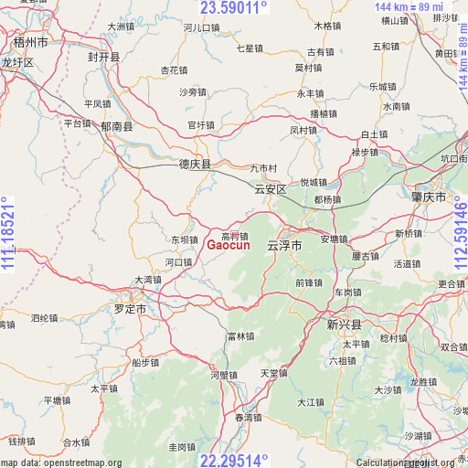
Gaocun GPS coordinates[2]
22° 56' 39.012" North, 111° 53' 17.988" East
| Map corner | latitude | longitude |
|---|---|---|
| Upper-left | 23.59011°, | 111.18521° |
| Center: | 22.94417°, | 111.88833° |
| Lower-right: | 22.29514°, | 112.59146° |
| Map W x H: | 144×144 km | = 89.5×89.5mi |
| max Lat: | 53.31946° ⇑94.8% North |
| Gaocun: | 22.94417° |
| min Lat: | ⇓5.2% South 18.22056° |
| min Long | Gaocun | max Long |
| 75.07348° | 111.88833° | 134.28917° |
| W 36.8%⇐ | ⇒63.2% E |
Elevation
Elevation of Gaocun is 67 m = 220 ft, and this is 417.8 m = 1371 ft below average elevation for this country.
| Max E: |
5622 m = 18445 ft | 66.4% |
| Avg. | 484.8 m = 1591 ft | |
| Gaocun | 67 m = 220 ft | |
Min E: |
-3 m = -10 ft | 33.6% |
See also: China elevation on elevation.city.
Geographical zone
Gaocun is located in North Torrid zone (between Equator and Tropic of Cancer). Distance of this Northern Tropic circle is 54.8 km =34.1 mi to North.| Distance of | km | miles | from Gaocun |
|---|---|---|---|
| North Pole | 7455.9 | 4632.9 | to North |
| Arctic Circle | 4850 | 3013.6 | to North |
| Tropic Cancer | 54.8 | 34.1 | to North |
| Equator | 2551.2 | 1585.2 | to South |


Nearby cities:
15 places around Gaocun: (largest is in red/bold)
• Baishi
16.7 km =10.4 mi,  214°
214°
• Decheng
24.7 km =15.3 mi,  333°
333°
• Dongba
14 km =8.7 mi,  268°
268°
• Gaofeng
15.8 km =9.8 mi,  83°
83°
• Hekou
19.2 km =11.9 mi,  244°
244°
• Hekou
22.9 km =14.2 mi, 84°
• Jiushi
23 km =14.3 mi,  21°
21°
• Liantan
16.9 km =10.5 mi, 266°
• Lidong
23.4 km =14.5 mi,  278°
278°
• Liudu
18.9 km =11.7 mi,  38°
38°
• Nanjiangkou
21.7 km =13.5 mi,  338°
338°
• Nansheng
22 km =13.7 mi,  125°
125°
• Songgui
13.6 km =8.5 mi,  250°
250°
• Yuncheng
16.5 km =10.3 mi,  90°
90°
• Yunfu
15.6 km =9.7 mi,  96°
96°
Sources, notices
• [Note1] Compared only with cities in China existing in our database
• [Src1] Map data: © OpenStreetMap contributors (CC-BY-SA)
• [Src2] Other city data from geonames.org with taken over terms of usage.
• [Src3] Geographical zone / Annual Mean Temperature by Robert A. Rohde @ Wikipedia
