Fengxiang geodata
Fengxiang (Gansu) is a seat of a fourth-order administrative division; located in China in Asia/Shanghai (GMT+8) time zone. In our database, there are 1268 cities with bigger population. Compared to other cities in China, 65.6% of cities are located further ↓South; 88.6% of cities are located further →East and 86.9% of cities have lower elevation than Fengxiang. Note1


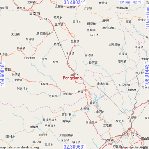
Fengxiang GPS coordinates[2]
32° 54' 6.984" North, 105° 18' 40.68" East
| Map corner | latitude | longitude |
|---|---|---|
| Upper-left | 33.49031°, | 104.60818° |
| Center: | 32.90194°, | 105.3113° |
| Lower-right: | 32.30963°, | 106.01443° |
| Map W x H: | 131.3×131.3 km | = 81.6×81.6mi |
| max Lat: | 53.31946° ⇑34.4% North |
| Fengxiang: | 32.90194° |
| min Lat: | ⇓65.6% South 18.22056° |
| min Long | Fengxiang | max Long |
| 75.07348° | 105.3113° | 134.28917° |
| W 11.4%⇐ | ⇒88.6% E |
Elevation
Elevation of Fengxiang is 1107 m = 3632 ft, and this is 622.2 m = 2041 ft above average elevation for this country.
| Max E: |
5622 m = 18445 ft | 13.1% |
| Fengxiang | 1107 m 3632 ft | |
| Avg. | 484.8 m = 1591 ft | |
Min E: |
-3 m = -10 ft | 86.9% |
See also: China elevation on elevation.city.
Geographical zone
Fengxiang is located in North temperate zone (between Tropic of Cancer and the Arctic Circle). Distance of this Northern Tropic circle is 1052.4 km =653.9 mi to South.| Distance of | km | miles | from Fengxiang |
|---|---|---|---|
| North Pole | 6348.7 | 3944.9 | to North |
| Arctic Circle | 3742.8 | 2325.7 | to North |
| Tropic Cancer | 1052.4 | 653.9 | to South |
| Equator | 3658.4 | 2273.2 | to South |


Nearby cities:
15 places around Fengxiang: (largest is in red/bold)
• Banqiao
31.2 km =19.4 mi,  174°
174°
• Caohe
21.7 km =13.5 mi,  279°
279°
• Koutouba
34.7 km =21.6 mi, 277°
• Luotang
18.9 km =11.7 mi,  346°
346°
• Pandi
17.4 km =10.8 mi,  316°
316°
• Pipa
29.4 km =18.3 mi,  0°
0°
• Qiaozhuang
35.4 km =22 mi,  191°
191°
• Sancang
22.1 km =13.7 mi,  304°
304°
• Shazhou
30.4 km =18.9 mi,  148°
148°
• Weihe
10.4 km =6.5 mi,  6°
6°
• Wuku
31.1 km =19.3 mi, 296°
• Wuma
21.7 km =13.5 mi,  34°
34°
• Xizhi
19.9 km =12.4 mi, 12°
• Yuezhao
30 km =18.6 mi,  332°
332°
• Yuhe
19.6 km =12.2 mi,  56°
56°
Sources, notices
• [Note1] Compared only with cities in China existing in our database
• [Src1] Map data: © OpenStreetMap contributors (CC-BY-SA)
• [Src2] Other city data from geonames.org with taken over terms of usage.
• [Src3] Geographical zone / Annual Mean Temperature by Robert A. Rohde @ Wikipedia
