Fengsheng geodata
Fengsheng (Chongqing) is a seat of a fourth-order administrative division; located in China in Asia/Shanghai (GMT+8) time zone. In our database, there are 1268 cities with bigger population. Compared to other cities in China, 59.4% of cities are located further ↑North; 83.9% of cities are located further →East and 75.7% of cities have lower elevation than Fengsheng. Note1


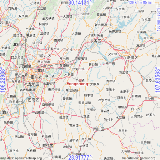
Fengsheng GPS coordinates[2]
29° 31' 53.004" North, 106° 55' 57" East
| Map corner | latitude | longitude |
|---|---|---|
| Upper-left | 30.14131°, | 106.22938° |
| Center: | 29.53139°, | 106.9325° |
| Lower-right: | 28.91777°, | 107.63563° |
| Map W x H: | 136×136 km | = 84.5×84.5mi |
| max Lat: | 53.31946° ⇑59.4% North |
| Fengsheng: | 29.53139° |
| min Lat: | ⇓40.6% South 18.22056° |
| min Long | Fengsheng | max Long |
| 75.07348° | 106.9325° | 134.28917° |
| W 16.1%⇐ | ⇒83.9% E |
Elevation
Elevation of Fengsheng is 539 m = 1768 ft, and this is 54.2 m = 178 ft above average elevation for this country.
| Max E: |
5622 m = 18445 ft | 24.3% |
| Fengsheng | 539 m 1768 ft | |
| Avg. | 484.8 m = 1591 ft | |
Min E: |
-3 m = -10 ft | 75.7% |
See also: China elevation on elevation.city.
Geographical zone
Fengsheng is located in North temperate zone (between Tropic of Cancer and the Arctic Circle). Distance of this Northern Tropic circle is 677.7 km =421.1 mi to South.| Distance of | km | miles | from Fengsheng |
|---|---|---|---|
| North Pole | 6723.5 | 4177.8 | to North |
| Arctic Circle | 4117.6 | 2558.6 | to North |
| Tropic Cancer | 677.7 | 421.1 | to South |
| Equator | 3283.6 | 2040.3 | to South |


Nearby cities:
15 places around Fengsheng: (largest is in red/bold)
• Fusheng
18.7 km =11.6 mi,  313°
313°
• Guangyang
18.4 km =11.4 mi,  288°
288°
• Lianghui
19.9 km =12.4 mi,  54°
54°
• Longtan
19 km =11.8 mi,  119°
119°
• Luoqi
20.3 km =12.6 mi,  0°
0°
• Maliuzui
18 km =11.2 mi, 3°
• Mingjia
12.7 km =7.9 mi,  104°
104°
• Mudong
10.1 km =6.3 mi,  298°
298°
• Shuanghekou
9.8 km =6.1 mi,  351°
351°
• Wubao
15 km =9.3 mi,  318°
318°
• Xincun
18.9 km =11.7 mi,  137°
137°
• Xinmiao
17.8 km =11.1 mi,  39°
39°
• Yinglong
21.1 km =13.1 mi,  266°
266°
• Yuzui
19.2 km =11.9 mi, 300°
• Zengfu
5.6 km =3.5 mi,  114°
114°
Sources, notices
• [Note1] Compared only with cities in China existing in our database
• [Src1] Map data: © OpenStreetMap contributors (CC-BY-SA)
• [Src2] Other city data from geonames.org with taken over terms of usage.
• [Src3] Geographical zone / Annual Mean Temperature by Robert A. Rohde @ Wikipedia
