Shuangjiang geodata
Shuangjiang (Guangdong) is a seat of a fourth-order administrative division; located in China in Asia/Shanghai (GMT+8) time zone. In our database, there are 1268 cities with bigger population. Compared to other cities in China, 90.6% of cities are located further ↑North; 52.7% of cities are located further ←West and 55.6% of cities have higher elevation than Shuangjiang. Note1


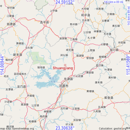
Shuangjiang GPS coordinates[2]
23° 57' 1.98" North, 114° 42' 45.216" East
| Map corner | latitude | longitude |
|---|---|---|
| Upper-left | 24.59152°, | 114.00944° |
| Center: | 23.95055°, | 114.71256° |
| Lower-right: | 23.30638°, | 115.41569° |
| Map W x H: | 142.9×142.9 km | = 88.8×88.8mi |
| max Lat: | 53.31946° ⇑90.6% North |
| Shuangjiang: | 23.95055° |
| min Lat: | ⇓9.4% South 18.22056° |
| min Long | Shuangjiang | max Long |
| 75.07348° | 114.71256° | 134.28917° |
| W 52.7%⇐ | ⇒47.3% E |
Elevation
Elevation of Shuangjiang is 127 m = 417 ft, and this is 357.8 m = 1174 ft below average elevation for this country.
| Max E: |
5622 m = 18445 ft | 55.6% |
| Avg. | 484.8 m = 1591 ft | |
| Shuangjiang | 127 m = 417 ft | |
Min E: |
-3 m = -10 ft | 44.4% |
See also: China elevation on elevation.city.
Geographical zone
Shuangjiang is located in North temperate zone (between Tropic of Cancer and the Arctic Circle). Distance of this Northern Tropic circle is 57.1 km =35.5 mi to South.| Distance of | km | miles | from Shuangjiang |
|---|---|---|---|
| North Pole | 7344 | 4563.3 | to North |
| Arctic Circle | 4738.1 | 2944.1 | to North |
| Tropic Cancer | 57.1 | 35.5 | to South |
| Equator | 2663.1 | 1654.8 | to South |


Nearby cities:
15 places around Shuangjiang: (largest is in red/bold)
• Banjiang
18.5 km =11.5 mi,  300°
300°
• Dengta
10.1 km =6.3 mi,  48°
48°
• Dongpu
22.2 km =13.8 mi,  185°
185°
• Heyuan
24.3 km =15.1 mi, 187°
• Huangsha
27.9 km =17.3 mi,  28°
28°
• Jiantou
11.3 km =7 mi,  353°
353°
• Luohu
19.5 km =12.1 mi,  56°
56°
• Shangcheng
23.4 km =14.5 mi,  183°
183°
• Shuntian
17.7 km =11 mi,  16°
16°
• Xiantang
15 km =9.3 mi,  158°
158°
• Xichang
26.5 km =16.5 mi,  264°
264°
• Xingang
20.2 km =12.6 mi,  201°
201°
• Yihe
20.5 km =12.7 mi,  126°
126°
• Yuannan
22.9 km =14.2 mi, 186°
• Zhangxi
27.2 km =16.9 mi, 51°
Sources, notices
• [Note1] Compared only with cities in China existing in our database
• [Src1] Map data: © OpenStreetMap contributors (CC-BY-SA)
• [Src2] Other city data from geonames.org with taken over terms of usage.
• [Src3] Geographical zone / Annual Mean Temperature by Robert A. Rohde @ Wikipedia
