Huilong geodata
Huilong (Guangdong) is a seat of a fourth-order administrative division; located in China in Asia/Shanghai (GMT+8) time zone. In our database, there are 1268 cities with bigger population. Compared to other cities in China, 93.5% of cities are located further ↑North; 64% of cities are located further →East and 76.7% of cities have higher elevation than Huilong. Note1


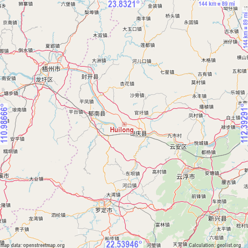
Huilong GPS coordinates[2]
23° 11' 14.424" North, 111° 41' 23.208" East
| Map corner | latitude | longitude |
|---|---|---|
| Upper-left | 23.8321°, | 110.98666° |
| Center: | 23.18734°, | 111.68978° |
| Lower-right: | 22.53946°, | 112.39291° |
| Map W x H: | 143.7×143.7 km | = 89.3×89.3mi |
| max Lat: | 53.31946° ⇑93.5% North |
| Huilong: | 23.18734° |
| min Lat: | ⇓6.5% South 18.22056° |
| min Long | Huilong | max Long |
| 75.07348° | 111.68978° | 134.28917° |
| W 36%⇐ | ⇒64% E |
Elevation
Elevation of Huilong is 33 m = 108 ft, and this is 451.8 m = 1482 ft below average elevation for this country.
| Max E: |
5622 m = 18445 ft | 76.7% |
| Avg. | 484.8 m = 1591 ft | |
| Huilong | 33 m = 108 ft | |
Min E: |
-3 m = -10 ft | 23.3% |
See also: China elevation on elevation.city.
Geographical zone
Huilong is located in North Torrid zone (between Equator and Tropic of Cancer). Distance of this Northern Tropic circle is 27.7 km =17.2 mi to North.| Distance of | km | miles | from Huilong |
|---|---|---|---|
| North Pole | 7428.9 | 4616.1 | to North |
| Arctic Circle | 4823 | 2996.9 | to North |
| Tropic Cancer | 27.7 | 17.2 | to North |
| Equator | 2578.2 | 1602 | to South |


Nearby cities:
15 places around Huilong: (largest is in red/bold)
• Baozhu
11.6 km =7.2 mi,  224°
224°
• Changgang
15.1 km =9.4 mi,  311°
311°
• Dafang
26.5 km =16.5 mi,  205°
205°
• Decheng
10.4 km =6.5 mi,  118°
118°
• Ducheng
17.6 km =10.9 mi,  290°
290°
• Guanxu
13.1 km =8.1 mi,  54°
54°
• Guixu
23.8 km =14.8 mi,  260°
260°
• Jiancheng
16.4 km =10.2 mi,  249°
249°
• Lidong
23.7 km =14.7 mi,  186°
186°
• Luodong
22.8 km =14.2 mi,  340°
340°
• Maxu
16.1 km =10 mi,  68°
68°
• Nanjiangkou
14.1 km =8.8 mi, 119°
• Pingfeng
25.9 km =16.1 mi,  299°
299°
• Xinghua
23.8 km =14.8 mi,  6°
6°
• Xinxu
7.7 km =4.8 mi,  105°
105°
Sources, notices
• [Note1] Compared only with cities in China existing in our database
• [Src1] Map data: © OpenStreetMap contributors (CC-BY-SA)
• [Src2] Other city data from geonames.org with taken over terms of usage.
• [Src3] Geographical zone / Annual Mean Temperature by Robert A. Rohde @ Wikipedia
