Yanbanpu geodata
Yanbanpu (Hunan) is a seat of a fourth-order administrative division; located in China in Asia/Shanghai (GMT+8) time zone. In our database, there are 1268 cities with bigger population. Compared to other cities in China, 64.4% of cities are located further ↑North; 72.1% of cities are located further →East and 77.7% of cities have lower elevation than Yanbanpu. Note1


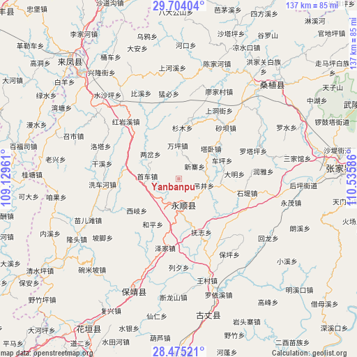
Yanbanpu GPS coordinates[2]
29° 5' 29.256" North, 109° 49' 57.828" East
| Map corner | latitude | longitude |
|---|---|---|
| Upper-left | 29.70404°, | 109.12961° |
| Center: | 29.09146°, | 109.83273° |
| Lower-right: | 28.47521°, | 110.53586° |
| Map W x H: | 136.6×136.6 km | = 84.9×84.9mi |
| max Lat: | 53.31946° ⇑64.4% North |
| Yanbanpu: | 29.09146° |
| min Lat: | ⇓35.6% South 18.22056° |
| min Long | Yanbanpu | max Long |
| 75.07348° | 109.83273° | 134.28917° |
| W 27.9%⇐ | ⇒72.1% E |
Elevation
Elevation of Yanbanpu is 604 m = 1982 ft, and this is 119.2 m = 391 ft above average elevation for this country.
| Max E: |
5622 m = 18445 ft | 22.3% |
| Yanbanpu | 604 m 1982 ft | |
| Avg. | 484.8 m = 1591 ft | |
Min E: |
-3 m = -10 ft | 77.7% |
See also: China elevation on elevation.city.
Geographical zone
Yanbanpu is located in North temperate zone (between Tropic of Cancer and the Arctic Circle). Distance of this Northern Tropic circle is 628.7 km =390.7 mi to South.| Distance of | km | miles | from Yanbanpu |
|---|---|---|---|
| North Pole | 6772.4 | 4208.2 | to North |
| Arctic Circle | 4166.5 | 2588.9 | to North |
| Tropic Cancer | 628.7 | 390.7 | to South |
| Equator | 3234.7 | 2009.9 | to South |


Nearby cities:
15 places around Yanbanpu: (largest is in red/bold)
• Cheping
17.9 km =11.1 mi,  66°
66°
• Daba
17.9 km =11.1 mi,  190°
190°
• Diaojingyan
9.7 km =6 mi,  106°
106°
• Guancangping
13.1 km =8.1 mi,  39°
39°
• Heping
20.1 km =12.5 mi,  209°
209°
• Kesha
11.2 km =7 mi,  87°
87°
• Liandonggang
10.5 km =6.5 mi,  152°
152°
• Liangchahe
14.5 km =9 mi,  310°
310°
• Lingxi
9.7 km =6 mi,  173°
173°
• Maoba
20.8 km =12.9 mi,  14°
14°
• Shanmu
19.5 km =12.1 mi,  3°
3°
• Shaoha
9.9 km =6.2 mi,  219°
219°
• Tawo
16.8 km =10.4 mi,  46°
46°
• Xinzhaiping
7.5 km =4.7 mi, 50°
• Xiqi
20.2 km =12.6 mi,  233°
233°
Sources, notices
• [Note1] Compared only with cities in China existing in our database
• [Src1] Map data: © OpenStreetMap contributors (CC-BY-SA)
• [Src2] Other city data from geonames.org with taken over terms of usage.
• [Src3] Geographical zone / Annual Mean Temperature by Robert A. Rohde @ Wikipedia
