Xiaozhang geodata
Xiaozhang (Hunan) is a seat of a fourth-order administrative division; located in China in Asia/Shanghai (GMT+8) time zone. In our database, there are 1268 cities with bigger population. Compared to other cities in China, 73.1% of cities are located further ↑North; 71.8% of cities are located further →East and 67.1% of cities have lower elevation than Xiaozhang. Note1


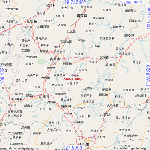
Xiaozhang GPS coordinates[2]
28° 7' 37.812" North, 109° 53' 6.432" East
| Map corner | latitude | longitude |
|---|---|---|
| Upper-left | 28.74546°, | 109.182° |
| Center: | 28.12717°, | 109.88512° |
| Lower-right: | 27.5053°, | 110.58825° |
| Map W x H: | 137.9×137.9 km | = 85.7×85.7mi |
| max Lat: | 53.31946° ⇑73.1% North |
| Xiaozhang: | 28.12717° |
| min Lat: | ⇓26.9% South 18.22056° |
| min Long | Xiaozhang | max Long |
| 75.07348° | 109.88512° | 134.28917° |
| W 28.2%⇐ | ⇒71.8% E |
Elevation
Elevation of Xiaozhang is 360 m = 1181 ft, and this is 124.8 m = 409 ft below average elevation for this country.
| Max E: |
5622 m = 18445 ft | 32.9% |
| Avg. | 484.8 m = 1591 ft | |
| Xiaozhang | 360 m = 1181 ft | |
Min E: |
-3 m = -10 ft | 67.1% |
See also: China elevation on elevation.city.
Geographical zone
Xiaozhang is located in North temperate zone (between Tropic of Cancer and the Arctic Circle). Distance of this Northern Tropic circle is 521.5 km =324 mi to South.| Distance of | km | miles | from Xiaozhang |
|---|---|---|---|
| North Pole | 6879.6 | 4274.8 | to North |
| Arctic Circle | 4273.7 | 2655.6 | to North |
| Tropic Cancer | 521.5 | 324 | to South |
| Equator | 3127.4 | 1943.3 | to South |


Nearby cities:
15 places around Xiaozhang: (largest is in red/bold)
• Dehang
21.8 km =13.5 mi,  336°
336°
• Ganziping
24 km =14.9 mi,  288°
288°
• Heshui
16.8 km =10.4 mi,  165°
165°
• Hexi
12.9 km =8 mi,  326°
326°
• Jiefangyan
14.4 km =8.9 mi,  270°
270°
• Mujiangping
18.3 km =11.4 mi,  241°
241°
• Pushi
21.2 km =13.2 mi,  103°
103°
• Qianzhou
26 km =16.2 mi, 325°
• Qiaoxikou
21.9 km =13.6 mi, 244°
• Sangongqiao
24.2 km =15 mi, 286°
• Shuangtang
19.1 km =11.9 mi, 292°
• Taiping
21.7 km =13.5 mi,  348°
348°
• Tanxi
16.8 km =10.4 mi,  22°
22°
• Wanrongjiang
23.7 km =14.7 mi,  307°
307°
• Xinglongchang
9.2 km =5.7 mi,  202°
202°
Sources, notices
• [Note1] Compared only with cities in China existing in our database
• [Src1] Map data: © OpenStreetMap contributors (CC-BY-SA)
• [Src2] Other city data from geonames.org with taken over terms of usage.
• [Src3] Geographical zone / Annual Mean Temperature by Robert A. Rohde @ Wikipedia
