Yezhu geodata
Yezhu (Hunan) is a seat of a fourth-order administrative division; located in China in Asia/Shanghai (GMT+8) time zone. In our database, there are 1268 cities with bigger population. Compared to other cities in China, 69.3% of cities are located further ↑North; 71% of cities are located further →East and 72.4% of cities have lower elevation than Yezhu. Note1


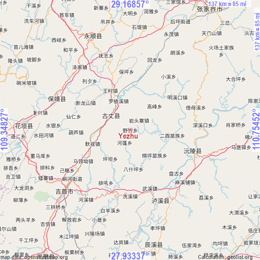
Yezhu GPS coordinates[2]
28° 33' 10.008" North, 110° 3' 5.004" East
| Map corner | latitude | longitude |
|---|---|---|
| Upper-left | 29.16857°, | 109.34827° |
| Center: | 28.55278°, | 110.05139° |
| Lower-right: | 27.93337°, | 110.75452° |
| Map W x H: | 137.3×137.3 km | = 85.3×85.3mi |
| max Lat: | 53.31946° ⇑69.3% North |
| Yezhu: | 28.55278° |
| min Lat: | ⇓30.7% South 18.22056° |
| min Long | Yezhu | max Long |
| 75.07348° | 110.05139° | 134.28917° |
| W 29%⇐ | ⇒71% E |
Elevation
Elevation of Yezhu is 461 m = 1512 ft, and this is 23.8 m = 78 ft below average elevation for this country.
| Max E: |
5622 m = 18445 ft | 27.6% |
| Avg. | 484.8 m = 1591 ft | |
| Yezhu | 461 m = 1512 ft | |
Min E: |
-3 m = -10 ft | 72.4% |
See also: China elevation on elevation.city.
Geographical zone
Yezhu is located in North temperate zone (between Tropic of Cancer and the Arctic Circle). Distance of this Northern Tropic circle is 568.9 km =353.5 mi to South.| Distance of | km | miles | from Yezhu |
|---|---|---|---|
| North Pole | 6832.3 | 4245.4 | to North |
| Arctic Circle | 4226.4 | 2626.2 | to North |
| Tropic Cancer | 568.9 | 353.5 | to South |
| Equator | 3174.8 | 1972.7 | to South |


Nearby cities:
15 places around Yezhu: (largest is in red/bold)
• Baiyan
22.6 km =14 mi,  199°
199°
• Baiyan
24.4 km =15.2 mi,  233°
233°
• Baoping
30.1 km =18.7 mi,  355°
355°
• Duanlongshan
27.6 km =17.1 mi,  301°
301°
• Gaofeng
18.1 km =11.2 mi,  45°
45°
• Guyang
13.4 km =8.3 mi, 300°
• Hulu
28.7 km =17.8 mi,  267°
267°
• Majing’ao
29.7 km =18.5 mi,  236°
236°
• Morong
21.1 km =13.1 mi,  250°
250°
• Pingba
19.3 km =12 mi,  214°
214°
• Qietong
24.4 km =15.2 mi,  315°
315°
• Qiping
18.5 km =11.5 mi,  135°
135°
• Shanzao
10.3 km =6.4 mi,  154°
154°
• Shuangxi
18 km =11.2 mi,  292°
292°
• Wangcun
23.4 km =14.5 mi,  333°
333°
Sources, notices
• [Note1] Compared only with cities in China existing in our database
• [Src1] Map data: © OpenStreetMap contributors (CC-BY-SA)
• [Src2] Other city data from geonames.org with taken over terms of usage.
• [Src3] Geographical zone / Annual Mean Temperature by Robert A. Rohde @ Wikipedia
