Hongxing geodata
Hongxing (Heilongjiang) is a seat of a fourth-order administrative division; located in China in Asia/Shanghai (GMT+8) time zone. In our database, there are 1268 cities with bigger population. Compared to other cities in China, 94.1% of cities are located further ↓South; 99.9% of cities are located further ←West and 54.3% of cities have lower elevation than Hongxing. Note1


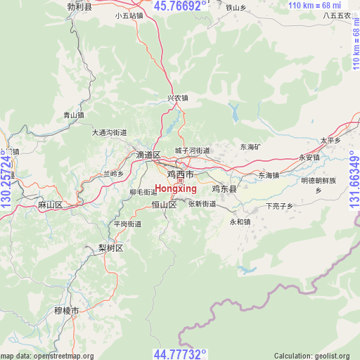
Hongxing GPS coordinates[2]
45° 16' 27.408" North, 130° 57' 37.296" East
| Map corner | latitude | longitude |
|---|---|---|
| Upper-left | 45.76692°, | 130.25724° |
| Center: | 45.27428°, | 130.96036° |
| Lower-right: | 44.77732°, | 131.66349° |
| Map W x H: | 110×110 km | = 68.4×68.4mi |
| max Lat: | 53.31946° ⇑5.9% North |
| Hongxing: | 45.27428° |
| min Lat: | ⇓94.1% South 18.22056° |
| min Long | Hongxing | max Long |
| 75.07348° | 130.96036° | 134.28917° |
| W 99.9%⇐ | ⇒0.099999999999994% E |
Elevation
Elevation of Hongxing is 200 m = 656 ft, and this is 284.8 m = 934 ft below average elevation for this country.
| Max E: |
5622 m = 18445 ft | 45.7% |
| Avg. | 484.8 m = 1591 ft | |
| Hongxing | 200 m = 656 ft | |
Min E: |
-3 m = -10 ft | 54.3% |
See also: China elevation on elevation.city.
Geographical zone
Hongxing is located in North temperate zone (between Tropic of Cancer and the Arctic Circle). Distance of this North polar circle is 2367.1 km =1470.8 mi to North.| Distance of | km | miles | from Hongxing |
|---|---|---|---|
| North Pole | 4973 | 3090.1 | to North |
| Arctic Circle | 2367.1 | 1470.8 | to North |
| Tropic Cancer | 2428.1 | 1508.8 | to South |
| Equator | 5034 | 3128 | to South |


Nearby cities:
15 places around Hongxing: (largest is in red/bold)
• Chengzihe
10.6 km =6.6 mi,  51°
51°
• Didaohe
12.5 km =7.8 mi,  312°
312°
• Dongxing
16.6 km =10.3 mi, 305°
• Fendou
8.2 km =5.1 mi,  213°
213°
• Hongjunlu
3.5 km =2.2 mi,  20°
20°
• Hongqi
7.4 km =4.6 mi,  201°
201°
• Jidong
11.6 km =7.2 mi,  123°
123°
• Jixi
3 km =1.9 mi,  355°
355°
• Kuishan
44.4 km =27.6 mi,  263°
263°
• Lanling
20.5 km =12.7 mi,  276°
276°
• Lishu
29.4 km =18.3 mi,  225°
225°
• Mashan
34.9 km =21.7 mi, 257°
• Xijiao
5.2 km =3.2 mi,  348°
348°
• Xingnong
25.3 km =15.7 mi, 357°
• Yahe
43.8 km =27.2 mi,  287°
287°
Sources, notices
• [Note1] Compared only with cities in China existing in our database
• [Src1] Map data: © OpenStreetMap contributors (CC-BY-SA)
• [Src2] Other city data from geonames.org with taken over terms of usage.
• [Src3] Geographical zone / Annual Mean Temperature by Robert A. Rohde @ Wikipedia
