Hongqi geodata
Hongqi (Heilongjiang) is a seat of a fourth-order administrative division; located in China in Asia/Shanghai (GMT+8) time zone. In our database, there are 1268 cities with bigger population. Compared to other cities in China, 94.1% of cities are located further ↓South; 99.8% of cities are located further ←West and 58.9% of cities have lower elevation than Hongqi. Note1


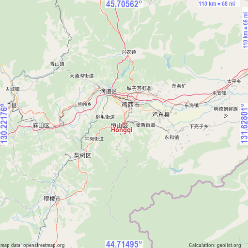
Hongqi GPS coordinates[2]
45° 12' 44.784" North, 130° 55' 29.568" East
| Map corner | latitude | longitude |
|---|---|---|
| Upper-left | 45.70562°, | 130.22176° |
| Center: | 45.21244°, | 130.92488° |
| Lower-right: | 44.71495°, | 131.62801° |
| Map W x H: | 110.2×110.2 km | = 68.5×68.5mi |
| max Lat: | 53.31946° ⇑5.9% North |
| Hongqi: | 45.21244° |
| min Lat: | ⇓94.1% South 18.22056° |
| min Long | Hongqi | max Long |
| 75.07348° | 130.92488° | 134.28917° |
| W 99.8%⇐ | ⇒0.2% E |
Elevation
Elevation of Hongqi is 246 m = 807 ft, and this is 238.8 m = 783 ft below average elevation for this country.
| Max E: |
5622 m = 18445 ft | 41.1% |
| Avg. | 484.8 m = 1591 ft | |
| Hongqi | 246 m = 807 ft | |
Min E: |
-3 m = -10 ft | 58.9% |
See also: China elevation on elevation.city.
Geographical zone
Hongqi is located in North temperate zone (between Tropic of Cancer and the Arctic Circle). Distance of this North polar circle is 2374 km =1475.1 mi to North.| Distance of | km | miles | from Hongqi |
|---|---|---|---|
| North Pole | 4979.9 | 3094.4 | to North |
| Arctic Circle | 2374 | 1475.1 | to North |
| Tropic Cancer | 2421.2 | 1504.5 | to South |
| Equator | 5027.2 | 3123.8 | to South |


Nearby cities:
15 places around Hongqi: (largest is in red/bold)
• Chengzihe
17.4 km =10.8 mi,  39°
39°
• Didaohe
16.7 km =10.4 mi,  337°
337°
• Dongxing
19.7 km =12.2 mi,  326°
326°
• Fendou
1.7 km =1.1 mi,  269°
269°
• Fulu
40.9 km =25.4 mi,  221°
221°
• Hongjunlu
10.9 km =6.8 mi,  21°
21°
• Hongxing
7.4 km =4.6 mi, 21°
• Jidong
12.4 km =7.7 mi,  87°
87°
• Jixi
10.2 km =6.3 mi,  14°
14°
• Kuishan
41.4 km =25.7 mi, 272°
• Lanling
19.8 km =12.3 mi,  297°
297°
• Lishu
22.8 km =14.2 mi,  233°
233°
• Mashan
31.2 km =19.4 mi, 268°
• Xijiao
12 km =7.5 mi, 8°
• Xingnong
32.2 km =20 mi,  2°
2°
Sources, notices
• [Note1] Compared only with cities in China existing in our database
• [Src1] Map data: © OpenStreetMap contributors (CC-BY-SA)
• [Src2] Other city data from geonames.org with taken over terms of usage.
• [Src3] Geographical zone / Annual Mean Temperature by Robert A. Rohde @ Wikipedia
