Targen geodata
Targen (Heilongjiang) is a seat of a fourth-order administrative division; located in China in Asia/Shanghai (GMT+8) time zone. In our database, there are 1268 cities with bigger population. Compared to other cities in China, 100% of cities are located further ↓South; 94.4% of cities are located further ←West and 68% of cities have lower elevation than Targen. Note1


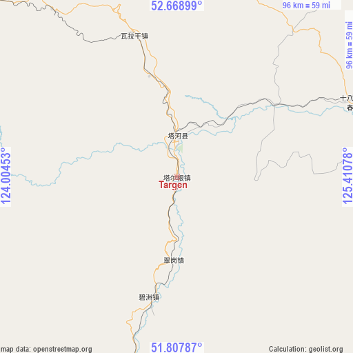
Targen GPS coordinates[2]
52° 14' 25.872" North, 124° 42' 27.54" East
| Map corner | latitude | longitude |
|---|---|---|
| Upper-left | 52.66899°, | 124.00453° |
| Center: | 52.24052°, | 124.70765° |
| Lower-right: | 51.80787°, | 125.41078° |
| Map W x H: | 95.7×95.7 km | = 59.5×59.5mi |
| max Lat: | 53.31946° ⇑0% North |
| Targen: | 52.24052° |
| min Lat: | ⇓100% South 18.22056° |
| min Long | Targen | max Long |
| 75.07348° | 124.70765° | 134.28917° |
| W 94.4%⇐ | ⇒5.6% E |
Elevation
Elevation of Targen is 377 m = 1237 ft, and this is 107.8 m = 354 ft below average elevation for this country.
| Max E: |
5622 m = 18445 ft | 32% |
| Avg. | 484.8 m = 1591 ft | |
| Targen | 377 m = 1237 ft | |
Min E: |
-3 m = -10 ft | 68% |
See also: China elevation on elevation.city.
Geographical zone
Targen is located in North temperate zone (between Tropic of Cancer and the Arctic Circle). Distance of this North polar circle is 1592.6 km =989.6 mi to North.| Distance of | km | miles | from Targen |
|---|---|---|---|
| North Pole | 4198.5 | 2608.8 | to North |
| Arctic Circle | 1592.6 | 989.6 | to North |
| Tropic Cancer | 3202.7 | 1990.1 | to South |
| Equator | 5808.6 | 3609.3 | to South |


Nearby cities:
15 places around Targen: (largest is in red/bold)
• Baiyinna
83.3 km =51.8 mi,  76°
76°
• Bishui
72 km =44.7 mi,  259°
259°
• Bizhou
33.9 km =21.1 mi,  192°
192°
• Cangshan
91.4 km =56.8 mi,  236°
236°
• Cuigang
22.2 km =13.8 mi,  182°
182°
• Dawusu
50.7 km =31.5 mi, 194°
• Hanjiayuan
72.6 km =45.1 mi,  105°
105°
• Hongtu
78.6 km =48.8 mi,  209°
209°
• Hongwei
77.8 km =48.3 mi,  247°
247°
• Huyuan
95.2 km =59.2 mi, 235°
• Linhai
75.5 km =46.9 mi,  198°
198°
• Tahe
10.5 km =6.5 mi,  9°
9°
• Tayuan
92.9 km =57.7 mi, 199°
• Xinghua
90 km =55.9 mi,  97°
97°
• Xinlin
65.3 km =40.6 mi, 203°
Sources, notices
• [Note1] Compared only with cities in China existing in our database
• [Src1] Map data: © OpenStreetMap contributors (CC-BY-SA)
• [Src2] Other city data from geonames.org with taken over terms of usage.
• [Src3] Geographical zone / Annual Mean Temperature by Robert A. Rohde @ Wikipedia
