Xinghua geodata
Xinghua (Heilongjiang) is a seat of a fourth-order administrative division; located in China in Asia/Shanghai (GMT+8) time zone. In our database, there are 1268 cities with bigger population. Compared to other cities in China, 99.9% of cities are located further ↓South; 95.5% of cities are located further ←West and 58.5% of cities have lower elevation than Xinghua. Note1


Xinghua GPS coordinates[2]
52° 7' 51.132" North, 126° 0' 58.572" East
| Map corner | latitude | longitude |
|---|---|---|
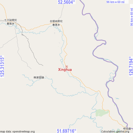
| Upper-left | 52.5604°, | 125.31315° |
| Center: | 52.13087°, | 126.01627° |
| Lower-right: | 51.69716°, | 126.7194° |
| Map W x H: | 96×96 km | = 59.7×59.7mi |
| max Lat: | 53.31946° ⇑0.1% North |
| Xinghua: | 52.13087° |
| min Lat: | ⇓99.9% South 18.22056° |
| min Long | Xinghua | max Long |
| 75.07348° | 126.01627° | 134.28917° |
| W 95.5%⇐ | ⇒4.5% E |
Elevation
Elevation of Xinghua is 241 m = 791 ft, and this is 243.8 m = 800 ft below average elevation for this country.
| Max E: |
5622 m = 18445 ft | 41.5% |
| Avg. | 484.8 m = 1591 ft | |
| Xinghua | 241 m = 791 ft | |
Min E: |
-3 m = -10 ft | 58.5% |
See also: China elevation on elevation.city.
Geographical zone
Xinghua is located in North temperate zone (between Tropic of Cancer and the Arctic Circle). Distance of this North polar circle is 1604.8 km =997.2 mi to North.| Distance of | km | miles | from Xinghua |
|---|---|---|---|
| North Pole | 4210.7 | 2616.4 | to North |
| Arctic Circle | 1604.8 | 997.2 | to North |
| Tropic Cancer | 3190.5 | 1982.5 | to South |
| Equator | 5796.4 | 3601.7 | to South |


Nearby cities:
15 places around Xinghua: (largest is in red/bold)
• Baiyinna
32.2 km =20 mi,  345°
345°
• Beijiang
121.6 km =75.6 mi,  177°
177°
• Bizhou
99.3 km =61.7 mi,  257°
257°
• Cuigang
90.8 km =56.4 mi, 263°
• Dawusu
109 km =67.7 mi,  250°
250°
• Hanjiayuan
20.9 km =13 mi, 248°
• Hongtu
140.1 km =87.1 mi, 246°
• Jinshan
33.5 km =20.8 mi,  87°
87°
• Khuma
62.5 km =38.8 mi,  137°
137°
• Linhai
128.8 km =80 mi,  242°
242°
• Oupu
72.6 km =45.1 mi,  2°
2°
• Sanka
125 km =77.7 mi,  150°
150°
• Tahe
90.2 km =56 mi,  284°
284°
• Targen
90 km =55.9 mi, 277°
• Xinlin
125 km =77.7 mi, 247°
Sources, notices
• [Note1] Compared only with cities in China existing in our database
• [Src1] Map data: © OpenStreetMap contributors (CC-BY-SA)
• [Src2] Other city data from geonames.org with taken over terms of usage.
• [Src3] Geographical zone / Annual Mean Temperature by Robert A. Rohde @ Wikipedia
