Cuigang geodata
Cuigang (Heilongjiang) is a seat of a fourth-order administrative division; located in China in Asia/Shanghai (GMT+8) time zone. In our database, there are 1268 cities with bigger population. Compared to other cities in China, 99.9% of cities are located further ↓South; 94.4% of cities are located further ←West and 69.9% of cities have lower elevation than Cuigang. Note1


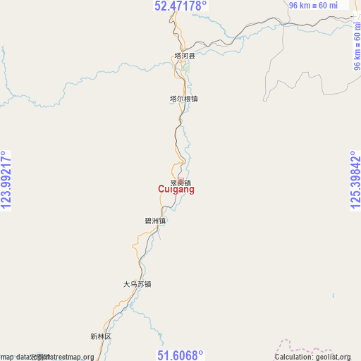
Cuigang GPS coordinates[2]
52° 2' 28.968" North, 124° 41' 43.044" East
| Map corner | latitude | longitude |
|---|---|---|
| Upper-left | 52.47178°, | 123.99217° |
| Center: | 52.04138°, | 124.69529° |
| Lower-right: | 51.6068°, | 125.39842° |
| Map W x H: | 96.2×96.2 km | = 59.8×59.8mi |
| max Lat: | 53.31946° ⇑0.1% North |
| Cuigang: | 52.04138° |
| min Lat: | ⇓99.9% South 18.22056° |
| min Long | Cuigang | max Long |
| 75.07348° | 124.69529° | 134.28917° |
| W 94.4%⇐ | ⇒5.6% E |
Elevation
Elevation of Cuigang is 409 m = 1342 ft, and this is 75.8 m = 249 ft below average elevation for this country.
| Max E: |
5622 m = 18445 ft | 30.1% |
| Avg. | 484.8 m = 1591 ft | |
| Cuigang | 409 m = 1342 ft | |
Min E: |
-3 m = -10 ft | 69.9% |
See also: China elevation on elevation.city.
Geographical zone
Cuigang is located in North temperate zone (between Tropic of Cancer and the Arctic Circle). Distance of this North polar circle is 1614.7 km =1003.3 mi to North.| Distance of | km | miles | from Cuigang |
|---|---|---|---|
| North Pole | 4220.6 | 2622.6 | to North |
| Arctic Circle | 1614.7 | 1003.3 | to North |
| Tropic Cancer | 3180.5 | 1976.3 | to South |
| Equator | 5786.5 | 3595.6 | to South |


Nearby cities:
15 places around Cuigang: (largest is in red/bold)
• Baiyinna
91.8 km =57 mi,  63°
63°
• Bishui
70.8 km =44 mi,  277°
277°
• Bizhou
12.8 km =8 mi,  211°
211°
• Cangshan
80.7 km =50.1 mi,  249°
249°
• Dawusu
29.5 km =18.3 mi,  204°
204°
• Hanjiayuan
70.9 km =44.1 mi,  88°
88°
• Hongtu
59.8 km =37.2 mi,  219°
219°
• Hongwei
71.7 km =44.6 mi,  264°
264°
• Huyuan
83.9 km =52.1 mi, 247°
• Linhai
54.7 km =34 mi, 205°
• Tahe
32.6 km =20.3 mi,  4°
4°
• Targen
22.2 km =13.8 mi, 2°
• Tayuan
72 km =44.7 mi, 204°
• Xinghua
90.8 km =56.4 mi,  83°
83°
• Xinlin
45.4 km =28.2 mi, 213°
Sources, notices
• [Note1] Compared only with cities in China existing in our database
• [Src1] Map data: © OpenStreetMap contributors (CC-BY-SA)
• [Src2] Other city data from geonames.org with taken over terms of usage.
• [Src3] Geographical zone / Annual Mean Temperature by Robert A. Rohde @ Wikipedia
