Bishui geodata
Bishui (Heilongjiang) is a seat of a fourth-order administrative division; located in China in Asia/Shanghai (GMT+8) time zone. In our database, there are 1268 cities with bigger population. Compared to other cities in China, 99.9% of cities are located further ↓South; 93.4% of cities are located further ←West and 73.3% of cities have lower elevation than Bishui. Note1


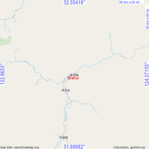
Bishui GPS coordinates[2]
52° 7' 28.524" North, 123° 40' 6.312" East
| Map corner | latitude | longitude |
|---|---|---|
| Upper-left | 52.55418°, | 122.9653° |
| Center: | 52.12459°, | 123.66842° |
| Lower-right: | 51.69082°, | 124.37155° |
| Map W x H: | 96×96 km | = 59.7×59.7mi |
| max Lat: | 53.31946° ⇑0.1% North |
| Bishui: | 52.12459° |
| min Lat: | ⇓99.9% South 18.22056° |
| min Long | Bishui | max Long |
| 75.07348° | 123.66842° | 134.28917° |
| W 93.4%⇐ | ⇒6.6% E |
Elevation
Elevation of Bishui is 482 m = 1581 ft, and this is 2.8 m = 9 ft below average elevation for this country.
| Max E: |
5622 m = 18445 ft | 26.7% |
| Avg. | 484.8 m = 1591 ft | |
| Bishui | 482 m = 1581 ft | |
Min E: |
-3 m = -10 ft | 73.3% |
See also: China elevation on elevation.city.
Geographical zone
Bishui is located in North temperate zone (between Tropic of Cancer and the Arctic Circle). Distance of this North polar circle is 1605.5 km =997.6 mi to North.| Distance of | km | miles | from Bishui |
|---|---|---|---|
| North Pole | 4211.4 | 2616.8 | to North |
| Arctic Circle | 1605.5 | 997.6 | to North |
| Tropic Cancer | 3189.8 | 1982 | to South |
| Equator | 5795.7 | 3601.3 | to South |


Nearby cities:
15 places around Bishui: (largest is in red/bold)
• Aoluguya Ewenke Minzu
108.6 km =67.5 mi,  273°
273°
• Bizhou
66.6 km =41.4 mi,  107°
107°
• Cangshan
37.8 km =23.5 mi,  187°
187°
• Cuigang
70.8 km =44 mi,  97°
97°
• Dawusu
68.5 km =42.6 mi,  121°
121°
• Hongtu
64.7 km =40.2 mi,  149°
149°
• Hongwei
16.5 km =10.3 mi,  183°
183°
• Huyuan
42 km =26.1 mi, 189°
• Linhai
75.1 km =46.7 mi,  141°
141°
• Tahe
76.1 km =47.3 mi,  72°
72°
• Targen
72 km =44.7 mi,  79°
79°
• Tayuan
85.4 km =53.1 mi, 151°
• Xilinji
100.6 km =62.5 mi,  343°
343°
• Xinlin
65.6 km =40.8 mi, 135°
• Xintian
109 km =67.7 mi,  160°
160°
Sources, notices
• [Note1] Compared only with cities in China existing in our database
• [Src1] Map data: © OpenStreetMap contributors (CC-BY-SA)
• [Src2] Other city data from geonames.org with taken over terms of usage.
• [Src3] Geographical zone / Annual Mean Temperature by Robert A. Rohde @ Wikipedia
