Ruiting geodata
Ruiting (Heilongjiang) is a seat of a fourth-order administrative division; located in China in Asia/Shanghai (GMT+8) time zone. In our database, there are 1268 cities with bigger population. Compared to other cities in China, 98.1% of cities are located further ↓South; 93.5% of cities are located further ←West and 50.8% of cities have higher elevation than Ruiting. Note1


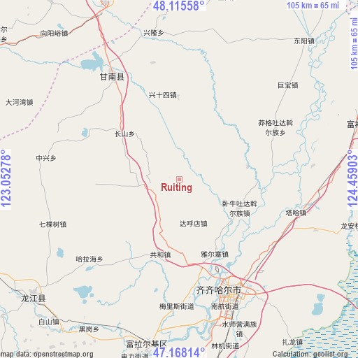
Ruiting GPS coordinates[2]
47° 38' 38.436" North, 123° 45' 21.24" East
| Map corner | latitude | longitude |
|---|---|---|
| Upper-left | 48.11558°, | 123.05278° |
| Center: | 47.64401°, | 123.7559° |
| Lower-right: | 47.16814°, | 124.45903° |
| Map W x H: | 105.3×105.3 km | = 65.4×65.4mi |
| max Lat: | 53.31946° ⇑1.9% North |
| Ruiting: | 47.64401° |
| min Lat: | ⇓98.1% South 18.22056° |
| min Long | Ruiting | max Long |
| 75.07348° | 123.7559° | 134.28917° |
| W 93.5%⇐ | ⇒6.5% E |
Elevation
Elevation of Ruiting is 158 m = 518 ft, and this is 326.8 m = 1072 ft below average elevation for this country.
| Max E: |
5622 m = 18445 ft | 50.8% |
| Avg. | 484.8 m = 1591 ft | |
| Ruiting | 158 m = 518 ft | |
Min E: |
-3 m = -10 ft | 49.2% |
See also: China elevation on elevation.city.
Geographical zone
Ruiting is located in North temperate zone (between Tropic of Cancer and the Arctic Circle). Distance of this North polar circle is 2103.7 km =1307.2 mi to North.| Distance of | km | miles | from Ruiting |
|---|---|---|---|
| North Pole | 4709.5 | 2926.3 | to North |
| Arctic Circle | 2103.7 | 1307.2 | to North |
| Tropic Cancer | 2691.6 | 1672.5 | to South |
| Equator | 5297.5 | 3291.7 | to South |


Nearby cities:
15 places around Ruiting: (largest is in red/bold)
• Bukui
35.3 km =21.9 mi,  155°
155°
• Changshan
21.1 km =13.1 mi,  310°
310°
• Dahudian
13.4 km =8.3 mi, 162°
• Gannan
35.5 km =22.1 mi,  327°
327°
• Gonghe
22.5 km =14 mi,  193°
193°
• Halahai
35.8 km =22.2 mi,  228°
228°
• Hali
36 km =22.4 mi, 192°
• Longhua
37.9 km =23.5 mi,  153°
153°
• Manggetu Dawo’er Zu
32.3 km =20.1 mi,  61°
61°
• Meilisi
36.6 km =22.7 mi,  180°
180°
• Qiqihar
37 km =23 mi, 155°
• Taha Man Zu
35.8 km =22.2 mi,  105°
105°
• Woniutu
19.6 km =12.2 mi,  117°
117°
• Ya’ersai
24.5 km =15.2 mi, 153°
• Yinhe
35.2 km =21.9 mi,  347°
347°
Sources, notices
• [Note1] Compared only with cities in China existing in our database
• [Src1] Map data: © OpenStreetMap contributors (CC-BY-SA)
• [Src2] Other city data from geonames.org with taken over terms of usage.
• [Src3] Geographical zone / Annual Mean Temperature by Robert A. Rohde @ Wikipedia
