Sifangtai geodata
Sifangtai (Heilongjiang) is a seat of a fourth-order administrative division; located in China in Asia/Shanghai (GMT+8) time zone. In our database, there are 1268 cities with bigger population. Compared to other cities in China, 96.8% of cities are located further ↓South; 96.7% of cities are located further ←West and 50.1% of cities have lower elevation than Sifangtai. Note1


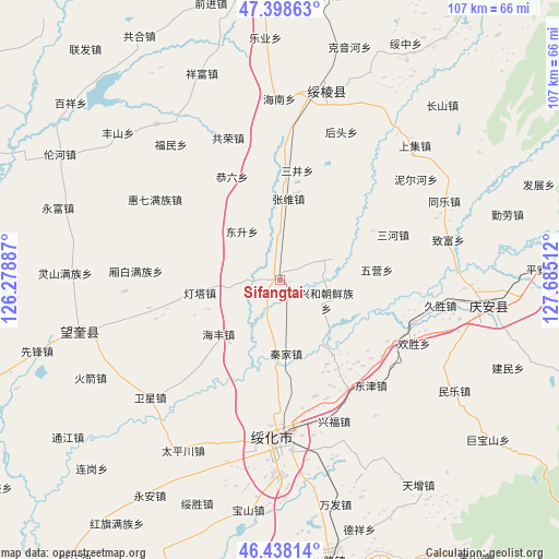
Sifangtai GPS coordinates[2]
46° 55' 13.944" North, 126° 58' 55.164" East
| Map corner | latitude | longitude |
|---|---|---|
| Upper-left | 47.39863°, | 126.27887° |
| Center: | 46.92054°, | 126.98199° |
| Lower-right: | 46.43814°, | 127.68512° |
| Map W x H: | 106.8×106.8 km | = 66.4×66.4mi |
| max Lat: | 53.31946° ⇑3.2% North |
| Sifangtai: | 46.92054° |
| min Lat: | ⇓96.8% South 18.22056° |
| min Long | Sifangtai | max Long |
| 75.07348° | 126.98199° | 134.28917° |
| W 96.7%⇐ | ⇒3.3% E |
Elevation
Elevation of Sifangtai is 166 m = 545 ft, and this is 318.8 m = 1046 ft below average elevation for this country.
| Max E: |
5622 m = 18445 ft | 49.9% |
| Avg. | 484.8 m = 1591 ft | |
| Sifangtai | 166 m = 545 ft | |
Min E: |
-3 m = -10 ft | 50.1% |
See also: China elevation on elevation.city.
Geographical zone
Sifangtai is located in North temperate zone (between Tropic of Cancer and the Arctic Circle). Distance of this North polar circle is 2184.1 km =1357.1 mi to North.| Distance of | km | miles | from Sifangtai |
|---|---|---|---|
| North Pole | 4790 | 2976.4 | to North |
| Arctic Circle | 2184.1 | 1357.1 | to North |
| Tropic Cancer | 2611.2 | 1622.5 | to South |
| Equator | 5217.1 | 3241.8 | to South |


Nearby cities:
15 places around Sifangtai: (largest is in red/bold)
• Dengta
15.4 km =9.6 mi,  261°
261°
• Dongjin
26.5 km =16.5 mi,  139°
139°
• Dongsheng
11.8 km =7.3 mi,  321°
321°
• Gongliu
21.9 km =13.6 mi,  335°
335°
• Haifeng
15.6 km =9.7 mi,  228°
228°
• Jinhe
24.3 km =15.1 mi,  147°
147°
• Lianhua
15.2 km =9.4 mi,  300°
300°
• Qinjia
13.9 km =8.6 mi,  174°
174°
• Sanhe
24.5 km =15.2 mi,  68°
68°
• Sanjing
21.2 km =13.2 mi,  8°
8°
• Shuanghe
14.7 km =9.1 mi,  106°
106°
• Wuying
18.8 km =11.7 mi,  83°
83°
• Xiangbai
27.3 km =17 mi,  273°
273°
• Xinghe
9.8 km =6.1 mi, 113°
• Zhangxiong
15.6 km =9.7 mi, 5°
Sources, notices
• [Note1] Compared only with cities in China existing in our database
• [Src1] Map data: © OpenStreetMap contributors (CC-BY-SA)
• [Src2] Other city data from geonames.org with taken over terms of usage.
• [Src3] Geographical zone / Annual Mean Temperature by Robert A. Rohde @ Wikipedia
