Zhangxiong geodata
Zhangxiong (Heilongjiang) is a seat of a fourth-order administrative division; located in China in Asia/Shanghai (GMT+8) time zone. In our database, there are 1268 cities with bigger population. Compared to other cities in China, 97.1% of cities are located further ↓South; 96.7% of cities are located further ←West and 50% of cities have lower elevation than Zhangxiong. Note1


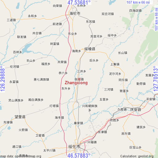
Zhangxiong GPS coordinates[2]
47° 3' 35.892" North, 127° 0' 7.2" East
| Map corner | latitude | longitude |
|---|---|---|
| Upper-left | 47.53681°, | 126.29888° |
| Center: | 47.05997°, | 127.002° |
| Lower-right: | 46.57883°, | 127.70513° |
| Map W x H: | 106.5×106.5 km | = 66.2×66.2mi |
| max Lat: | 53.31946° ⇑2.9% North |
| Zhangxiong: | 47.05997° |
| min Lat: | ⇓97.1% South 18.22056° |
| min Long | Zhangxiong | max Long |
| 75.07348° | 127.002° | 134.28917° |
| W 96.7%⇐ | ⇒3.3% E |
Elevation
Elevation of Zhangxiong is 165 m = 541 ft, and this is 319.8 m = 1049 ft below average elevation for this country.
| Max E: |
5622 m = 18445 ft | 50% |
| Avg. | 484.8 m = 1591 ft | |
| Zhangxiong | 165 m = 541 ft | |
Min E: |
-3 m = -10 ft | 50% |
See also: China elevation on elevation.city.
Geographical zone
Zhangxiong is located in North temperate zone (between Tropic of Cancer and the Arctic Circle). Distance of this North polar circle is 2168.6 km =1347.5 mi to North.| Distance of | km | miles | from Zhangxiong |
|---|---|---|---|
| North Pole | 4774.5 | 2966.7 | to North |
| Arctic Circle | 2168.6 | 1347.5 | to North |
| Tropic Cancer | 2626.7 | 1632.2 | to South |
| Equator | 5232.6 | 3251.4 | to South |


Nearby cities:
15 places around Zhangxiong: (largest is in red/bold)
• Dongsheng
10.9 km =6.8 mi,  234°
234°
• Fumin
24.3 km =15.1 mi,  295°
295°
• Gongliu
11.5 km =7.1 mi,  292°
292°
• Gongrong
16.3 km =10.1 mi,  315°
315°
• Hainan
19.2 km =11.9 mi,  355°
355°
• Houtou
16.4 km =10.2 mi,  38°
38°
• Kaoshan
21 km =13 mi,  29°
29°
• Lianhua
16.5 km =10.3 mi,  242°
242°
• Sanhe
22.2 km =13.8 mi,  106°
106°
• Sanjing
5.7 km =3.5 mi,  17°
17°
• Shuanghe
23.4 km =14.5 mi,  147°
147°
• Sifangtai
15.6 km =9.7 mi,  185°
185°
• Suileng
22.1 km =13.7 mi, 18°
• Wuying
21.8 km =13.5 mi,  128°
128°
• Xinghe
20.8 km =12.9 mi,  159°
159°
Sources, notices
• [Note1] Compared only with cities in China existing in our database
• [Src1] Map data: © OpenStreetMap contributors (CC-BY-SA)
• [Src2] Other city data from geonames.org with taken over terms of usage.
• [Src3] Geographical zone / Annual Mean Temperature by Robert A. Rohde @ Wikipedia
