Sanhe geodata
Sanhe (Inner Mongolia) is a seat of a fourth-order administrative division; located in China in Asia/Shanghai (GMT+8) time zone. In our database, there are 1268 cities with bigger population. Compared to other cities in China, 99.7% of cities are located further ↓South; 82.6% of cities are located further ←West and 79.1% of cities have lower elevation than Sanhe. Note1


Sanhe GPS coordinates[2]
50° 26' 56.724" North, 120° 6' 19.152" East
| Map corner | latitude | longitude |
|---|---|---|
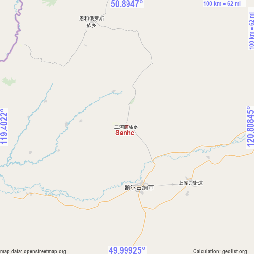
| Upper-left | 50.8947°, | 119.4022° |
| Center: | 50.44909°, | 120.10532° |
| Lower-right: | 49.99925°, | 120.80845° |
| Map W x H: | 99.6×99.6 km | = 61.9×61.9mi |
| max Lat: | 53.31946° ⇑0.3% North |
| Sanhe: | 50.44909° |
| min Lat: | ⇓99.7% South 18.22056° |
| min Long | Sanhe | max Long |
| 75.07348° | 120.10532° | 134.28917° |
| W 82.6%⇐ | ⇒17.4% E |
Elevation
Elevation of Sanhe is 654 m = 2146 ft, and this is 169.2 m = 555 ft above average elevation for this country.
| Max E: |
5622 m = 18445 ft | 20.9% |
| Sanhe | 654 m 2146 ft | |
| Avg. | 484.8 m = 1591 ft | |
Min E: |
-3 m = -10 ft | 79.1% |
See also: China elevation on elevation.city.
Geographical zone
Sanhe is located in North temperate zone (between Tropic of Cancer and the Arctic Circle). Distance of this North polar circle is 1791.8 km =1113.4 mi to North.| Distance of | km | miles | from Sanhe |
|---|---|---|---|
| North Pole | 4397.6 | 2732.5 | to North |
| Arctic Circle | 1791.8 | 1113.4 | to North |
| Tropic Cancer | 3003.5 | 1866.3 | to South |
| Equator | 5609.4 | 3485.5 | to South |


Nearby cities:
15 places around Sanhe: (largest is in red/bold)
• Bayan Hure
113.6 km =70.6 mi,  201°
201°
• Derbur
90.3 km =56.1 mi,  48°
48°
• E’erguna
25.5 km =15.8 mi,  169°
169°
• Genhe
106.3 km =66.1 mi,  69°
69°
• Haolibao
101.4 km =63 mi, 71°
• Heishantou
50 km =31.1 mi,  238°
238°
• Kudu’er
117 km =72.7 mi,  113°
113°
• Mo’er Daoga
101.4 km =63 mi,  27°
27°
• Shangkuli
33.2 km =20.6 mi,  130°
130°
• Shiwei
99.4 km =61.8 mi,  351°
351°
• Suqin Huimin
23.6 km =14.7 mi,  271°
271°
• Tulihe
111.1 km =69 mi,  88°
88°
• Xiniqi
113 km =70.2 mi, 93°
• Yitulihe
105.4 km =65.5 mi,  78°
78°
• Yuanlin
110.7 km =68.8 mi,  124°
124°
Sources, notices
• [Note1] Compared only with cities in China existing in our database
• [Src1] Map data: © OpenStreetMap contributors (CC-BY-SA)
• [Src2] Other city data from geonames.org with taken over terms of usage.
• [Src3] Geographical zone / Annual Mean Temperature by Robert A. Rohde @ Wikipedia
