Gannan geodata
Gannan (Heilongjiang) is a seat of a third-order administrative division; located in China in Asia/Shanghai (GMT+8) time zone. With population of 59,239 people, there are 741 cities with bigger population in this country. Compared to other cities in China, 98.5% of cities are located further ↓South; 93.2% of cities are located further ←West and 52.9% of cities have lower elevation than Gannan. Note1


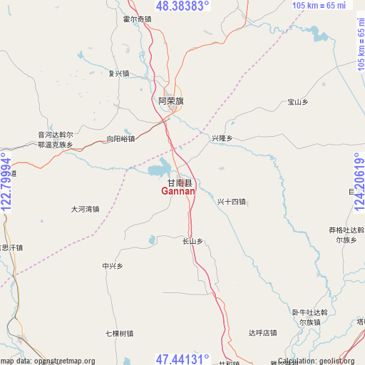
Gannan GPS coordinates[2]
47° 54' 52.992" North, 123° 30' 11.016" East
| Map corner | latitude | longitude |
|---|---|---|
| Upper-left | 48.38383°, | 122.79994° |
| Center: | 47.91472°, | 123.50306° |
| Lower-right: | 47.44131°, | 124.20619° |
| Map W x H: | 104.8×104.8 km | = 65.1×65.1mi |
| max Lat: | 53.31946° ⇑1.5% North |
| Gannan: | 47.91472° |
| min Lat: | ⇓98.5% South 18.22056° |
| min Long | Gannan | max Long |
| 75.07348° | 123.50306° | 134.28917° |
| W 93.2%⇐ | ⇒6.8% E |
Elevation
Elevation of Gannan is 188 m = 617 ft, and this is 296.8 m = 974 ft below average elevation for this country.
| Max E: |
5622 m = 18445 ft | 47.1% |
| Avg. | 484.8 m = 1591 ft | |
| Gannan | 188 m = 617 ft | |
Min E: |
-3 m = -10 ft | 52.9% |
See also: Gannan elevation on elevation.city.
Geographical zone
Gannan is located in North temperate zone (between Tropic of Cancer and the Arctic Circle). Distance of this North polar circle is 2073.6 km =1288.5 mi to North.| Distance of | km | miles | from Gannan |
|---|---|---|---|
| North Pole | 4679.4 | 2907.6 | to North |
| Arctic Circle | 2073.6 | 1288.5 | to North |
| Tropic Cancer | 2721.7 | 1691.2 | to South |
| Equator | 5327.6 | 3310.4 | to South |


Nearby cities:
15 places around Gannan: (largest is in red/bold)
• Baoshan
40.6 km =25.2 mi,  54°
54°
• Changshan
16.7 km =10.4 mi,  169°
169°
• Dahewan
28.9 km =18 mi,  255°
255°
• Dahudian
48.6 km =30.2 mi,  151°
151°
• Dawo’er Minzu
39.1 km =24.3 mi,  286°
286°
• Fuxing
36.5 km =22.7 mi,  329°
329°
• Honghualiangzi
29.2 km =18.1 mi,  319°
319°
• Naji
23.3 km =14.5 mi,  351°
351°
• Qikeshu
47 km =29.2 mi,  202°
202°
• Ruiting
35.5 km =22.1 mi, 147°
• Sandaogou
13.5 km =8.4 mi, 323°
• Xinglong
17.3 km =10.7 mi,  41°
41°
• Yinhe
11.8 km =7.3 mi,  68°
68°
• Yinhedahan’er
38.7 km =24 mi, 288°
• Zhongxing
31.2 km =19.4 mi,  220°
220°
Sources, notices
• [Note1] Compared only with cities in China existing in our database
• [Src1] Map data: © OpenStreetMap contributors (CC-BY-SA)
• [Src2] Other city data from geonames.org with taken over terms of usage.
• [Src3] Geographical zone / Annual Mean Temperature by Robert A. Rohde @ Wikipedia
