Qingchengzi geodata
Qingchengzi (Liaoning) is a seat of a fourth-order administrative division; located in China in Asia/Shanghai (GMT+8) time zone. In our database, there are 1268 cities with bigger population. Compared to other cities in China, 88.6% of cities are located further ↓South; 93.3% of cities are located further ←West and 60.2% of cities have lower elevation than Qingchengzi. Note1


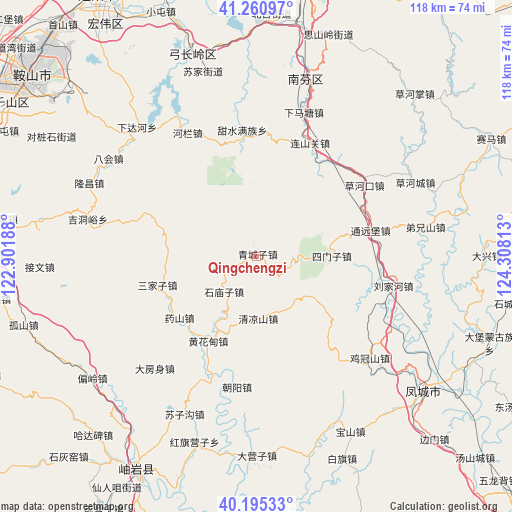
Qingchengzi GPS coordinates[2]
40° 43' 49.008" North, 123° 36' 18" East
| Map corner | latitude | longitude |
|---|---|---|
| Upper-left | 41.26097°, | 122.90188° |
| Center: | 40.73028°, | 123.605° |
| Lower-right: | 40.19533°, | 124.30813° |
| Map W x H: | 118.5×118.5 km | = 73.6×73.6mi |
| max Lat: | 53.31946° ⇑11.4% North |
| Qingchengzi: | 40.73028° |
| min Lat: | ⇓88.6% South 18.22056° |
| min Long | Qingchengzi | max Long |
| 75.07348° | 123.605° | 134.28917° |
| W 93.3%⇐ | ⇒6.7% E |
Elevation
Elevation of Qingchengzi is 261 m = 856 ft, and this is 223.8 m = 734 ft below average elevation for this country.
| Max E: |
5622 m = 18445 ft | 39.8% |
| Avg. | 484.8 m = 1591 ft | |
| Qingchengzi | 261 m = 856 ft | |
Min E: |
-3 m = -10 ft | 60.2% |
See also: China elevation on elevation.city.
Geographical zone
Qingchengzi is located in North temperate zone (between Tropic of Cancer and the Arctic Circle). Distance of this Northern Tropic circle is 1922.9 km =1194.8 mi to South.| Distance of | km | miles | from Qingchengzi |
|---|---|---|---|
| North Pole | 5478.3 | 3404.1 | to North |
| Arctic Circle | 2872.4 | 1784.8 | to North |
| Tropic Cancer | 1922.9 | 1194.8 | to South |
| Equator | 4528.8 | 2814.1 | to South |


Nearby cities:
15 places around Qingchengzi: (largest is in red/bold)
• Caohekou
30.1 km =18.7 mi,  56°
56°
• Chaoyang
30.7 km =19.1 mi,  188°
188°
• Dafangshen
35 km =21.7 mi,  221°
221°
• Hanghuadian
22.5 km =14 mi,  210°
210°
• Jiguanshan
35 km =21.7 mi,  131°
131°
• Jiucaigou
24.9 km =15.5 mi,  231°
231°
• Liujiahe
32.3 km =20.1 mi,  102°
102°
• Muniu
33 km =20.5 mi,  255°
255°
• Sanjiazi
24.1 km =15 mi,  253°
253°
• Shangmatun
31.2 km =19.4 mi,  319°
319°
• Shimiaozi
11.2 km =7 mi, 223°
• Simenzi
17.8 km =11.1 mi,  88°
88°
• Suzigou
40.2 km =25 mi,  204°
204°
• Tanggou
14.5 km =9 mi,  178°
178°
• Tongyuanpu
27.1 km =16.8 mi,  75°
75°
Sources, notices
• [Note1] Compared only with cities in China existing in our database
• [Src1] Map data: © OpenStreetMap contributors (CC-BY-SA)
• [Src2] Other city data from geonames.org with taken over terms of usage.
• [Src3] Geographical zone / Annual Mean Temperature by Robert A. Rohde @ Wikipedia
