Caohekou geodata
Caohekou (Liaoning) is a seat of a fourth-order administrative division; located in China in Asia/Shanghai (GMT+8) time zone. In our database, there are 1268 cities with bigger population. Compared to other cities in China, 88.9% of cities are located further ↓South; 93.7% of cities are located further ←West and 58.5% of cities have lower elevation than Caohekou. Note1


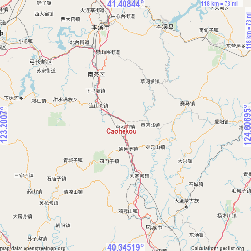
Caohekou GPS coordinates[2]
40° 52' 44.22" North, 123° 54' 13.752" East
| Map corner | latitude | longitude |
|---|---|---|
| Upper-left | 41.40844°, | 123.2007° |
| Center: | 40.87895°, | 123.90382° |
| Lower-right: | 40.34519°, | 124.60695° |
| Map W x H: | 118.2×118.2 km | = 73.4×73.4mi |
| max Lat: | 53.31946° ⇑11.1% North |
| Caohekou: | 40.87895° |
| min Lat: | ⇓88.9% South 18.22056° |
| min Long | Caohekou | max Long |
| 75.07348° | 123.90382° | 134.28917° |
| W 93.7%⇐ | ⇒6.3% E |
Elevation
Elevation of Caohekou is 241 m = 791 ft, and this is 243.8 m = 800 ft below average elevation for this country.
| Max E: |
5622 m = 18445 ft | 41.5% |
| Avg. | 484.8 m = 1591 ft | |
| Caohekou | 241 m = 791 ft | |
Min E: |
-3 m = -10 ft | 58.5% |
See also: China elevation on elevation.city.
Geographical zone
Caohekou is located in North temperate zone (between Tropic of Cancer and the Arctic Circle). Distance of this Northern Tropic circle is 1939.4 km =1205.1 mi to South.| Distance of | km | miles | from Caohekou |
|---|---|---|---|
| North Pole | 5461.7 | 3393.7 | to North |
| Arctic Circle | 2855.9 | 1774.6 | to North |
| Tropic Cancer | 1939.4 | 1205.1 | to South |
| Equator | 4545.3 | 2824.3 | to South |


Nearby cities:
15 places around Caohekou: (largest is in red/bold)
• Benxi
47 km =29.2 mi,  345°
345°
• Caohezhang
23.9 km =14.9 mi,  28°
28°
• Fengcheng
49.4 km =30.7 mi,  163°
163°
• Gongchangling
46.4 km =28.8 mi,  304°
304°
• Guanyinge
51.4 km =31.9 mi,  20°
20°
• Hanghuadian
51.2 km =31.8 mi,  225°
225°
• Jiguanshan
39.9 km =24.8 mi,  178°
178°
• Liujiahe
24.1 km =15 mi, 164°
• Qingchengzi
30.1 km =18.7 mi,  236°
236°
• Shangmatun
46 km =28.6 mi,  278°
278°
• Shimiaozi
41.1 km =25.5 mi, 233°
• Simenzi
17.8 km =11.1 mi,  204°
204°
• Tanggou
39.6 km =24.6 mi,  218°
218°
• Tongyuanpu
9.7 km =6 mi,  174°
174°
• Xiaoshi
49.9 km =31 mi, 21°
Sources, notices
• [Note1] Compared only with cities in China existing in our database
• [Src1] Map data: © OpenStreetMap contributors (CC-BY-SA)
• [Src2] Other city data from geonames.org with taken over terms of usage.
• [Src3] Geographical zone / Annual Mean Temperature by Robert A. Rohde @ Wikipedia
