Qasq geodata
Qasq (Inner Mongolia) is a seat of a third-order administrative division; located in China in Asia/Shanghai (GMT+8) time zone. In our database, there are 1268 cities with bigger population. Compared to other cities in China, 88.5% of cities are located further ↓South; 66.6% of cities are located further →East and 85.7% of cities have lower elevation than Qasq. Note1


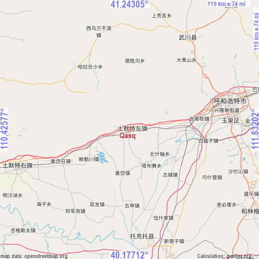
Qasq GPS coordinates[2]
40° 42' 43.992" North, 111° 7' 44.004" East
| Map corner | latitude | longitude |
|---|---|---|
| Upper-left | 41.24305°, | 110.42577° |
| Center: | 40.71222°, | 111.12889° |
| Lower-right: | 40.17712°, | 111.83202° |
| Map W x H: | 118.5×118.5 km | = 73.6×73.6mi |
| max Lat: | 53.31946° ⇑11.5% North |
| Qasq: | 40.71222° |
| min Lat: | ⇓88.5% South 18.22056° |
| min Long | Qasq | max Long |
| 75.07348° | 111.12889° | 134.28917° |
| W 33.4%⇐ | ⇒66.6% E |
Elevation
Elevation of Qasq is 1026 m = 3366 ft, and this is 541.2 m = 1776 ft above average elevation for this country.
| Max E: |
5622 m = 18445 ft | 14.3% |
| Qasq | 1026 m 3366 ft | |
| Avg. | 484.8 m = 1591 ft | |
Min E: |
-3 m = -10 ft | 85.7% |
See also: China elevation on elevation.city.
Geographical zone
Qasq is located in North temperate zone (between Tropic of Cancer and the Arctic Circle). Distance of this Northern Tropic circle is 1920.9 km =1193.6 mi to South.| Distance of | km | miles | from Qasq |
|---|---|---|---|
| North Pole | 5480.3 | 3405.3 | to North |
| Arctic Circle | 2874.4 | 1786.1 | to North |
| Tropic Cancer | 1920.9 | 1193.6 | to South |
| Equator | 4526.8 | 2812.8 | to South |


Nearby cities:
15 places around Qasq: (largest is in red/bold)
• Anzihao
51.9 km =32.2 mi,  29°
29°
• Daqingshan
41.5 km =25.8 mi,  39°
39°
• Dongtucheng
46.5 km =28.9 mi,  13°
13°
• Halamendu
45.7 km =28.4 mi,  311°
311°
• Haoxinying
52.8 km =32.8 mi,  69°
69°
• Har Huxu
34.1 km =21.2 mi,  328°
328°
• Hoh Ereg
50 km =31.1 mi, 31°
• Hohhot
45.4 km =28.2 mi,  76°
76°
• Miaogou
29.2 km =18.1 mi, 307°
• Moguyao
32.6 km =20.3 mi, 13°
• Nalinggou
31.9 km =19.8 mi,  4°
4°
• Shangtuhai
54.4 km =33.8 mi,  16°
16°
• Xiashihao
48.9 km =30.4 mi,  295°
295°
• Xiwulan Bulang
47.1 km =29.3 mi,  343°
343°
• Zhonghouhe
52.9 km =32.9 mi,  354°
354°
Sources, notices
• [Note1] Compared only with cities in China existing in our database
• [Src1] Map data: © OpenStreetMap contributors (CC-BY-SA)
• [Src2] Other city data from geonames.org with taken over terms of usage.
• [Src3] Geographical zone / Annual Mean Temperature by Robert A. Rohde @ Wikipedia
