Niu’erhe geodata
Niu’erhe (Inner Mongolia) is a seat of a fourth-order administrative division; located in China in Asia/Shanghai (GMT+8) time zone. In our database, there are 1268 cities with bigger population. Compared to other cities in China, 99.8% of cities are located further ↓South; 90.7% of cities are located further ←West and 80.4% of cities have lower elevation than Niu’erhe. Note1


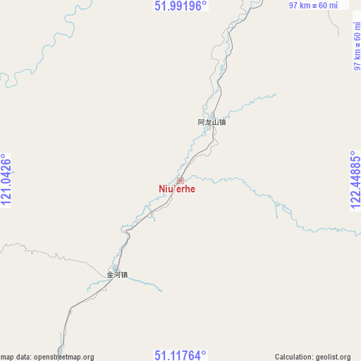
Niu’erhe GPS coordinates[2]
51° 33' 24.84" North, 121° 44' 44.592" East
| Map corner | latitude | longitude |
|---|---|---|
| Upper-left | 51.99196°, | 121.0426° |
| Center: | 51.5569°, | 121.74572° |
| Lower-right: | 51.11764°, | 122.44885° |
| Map W x H: | 97.2×97.2 km | = 60.4×60.4mi |
| max Lat: | 53.31946° ⇑0.2% North |
| Niu’erhe: | 51.5569° |
| min Lat: | ⇓99.8% South 18.22056° |
| min Long | Niu’erhe | max Long |
| 75.07348° | 121.74572° | 134.28917° |
| W 90.7%⇐ | ⇒9.3% E |
Elevation
Elevation of Niu’erhe is 717 m = 2352 ft, and this is 232.2 m = 762 ft above average elevation for this country.
| Max E: |
5622 m = 18445 ft | 19.6% |
| Niu’erhe | 717 m 2352 ft | |
| Avg. | 484.8 m = 1591 ft | |
Min E: |
-3 m = -10 ft | 80.4% |
See also: China elevation on elevation.city.
Geographical zone
Niu’erhe is located in North temperate zone (between Tropic of Cancer and the Arctic Circle). Distance of this North polar circle is 1668.6 km =1036.8 mi to North.| Distance of | km | miles | from Niu’erhe |
|---|---|---|---|
| North Pole | 4274.5 | 2656.1 | to North |
| Arctic Circle | 1668.6 | 1036.8 | to North |
| Tropic Cancer | 3126.7 | 1942.8 | to South |
| Equator | 5732.6 | 3562.1 | to South |


Nearby cities:
15 places around Niu’erhe: (largest is in red/bold)
• Alongshan
17.7 km =11 mi,  27°
27°
• Aoluguya Ewenke Minzu
72.5 km =45 mi,  18°
18°
• Cangshan
129.9 km =80.7 mi,  78°
78°
• Derbur
78.9 km =49 mi,  217°
217°
• Genhe
87.5 km =54.4 mi,  190°
190°
• Haolibao
93.4 km =58 mi, 191°
• Huyuan
127.4 km =79.2 mi, 80°
• Jinhe
30.2 km =18.8 mi, 216°
• Keyihe
114.8 km =71.3 mi,  152°
152°
• Mangui
58.2 km =36.2 mi, 22°
• Mo’er Daoga
75.3 km =46.8 mi,  243°
243°
• Qiqian
97 km =60.3 mi,  315°
315°
• Tulihe
119.5 km =74.3 mi,  182°
182°
• Xiniqi
130.3 km =81 mi, 181°
• Yitulihe
103.2 km =64.1 mi, 186°
Sources, notices
• [Note1] Compared only with cities in China existing in our database
• [Src1] Map data: © OpenStreetMap contributors (CC-BY-SA)
• [Src2] Other city data from geonames.org with taken over terms of usage.
• [Src3] Geographical zone / Annual Mean Temperature by Robert A. Rohde @ Wikipedia
