Nankou geodata
Nankou (Beijing) is a seat of a fourth-order administrative division; located in China in Asia/Shanghai (GMT+8) time zone. In our database, there are 1268 cities with bigger population. Compared to other cities in China, 87.3% of cities are located further ↓South; 60.8% of cities are located further ←West and 58.8% of cities have higher elevation than Nankou. Note1


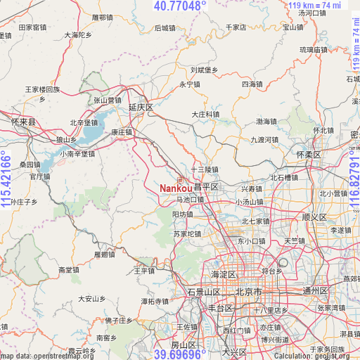
Nankou GPS coordinates[2]
40° 14' 9.06" North, 116° 7' 29.208" East
| Map corner | latitude | longitude |
|---|---|---|
| Upper-left | 40.77048°, | 115.42166° |
| Center: | 40.23585°, | 116.12478° |
| Lower-right: | 39.69696°, | 116.82791° |
| Map W x H: | 119.4×119.4 km | = 74.2×74.2mi |
| max Lat: | 53.31946° ⇑12.7% North |
| Nankou: | 40.23585° |
| min Lat: | ⇓87.3% South 18.22056° |
| min Long | Nankou | max Long |
| 75.07348° | 116.12478° | 134.28917° |
| W 60.8%⇐ | ⇒39.2% E |
Elevation
Elevation of Nankou is 106 m = 348 ft, and this is 378.8 m = 1243 ft below average elevation for this country.
| Max E: |
5622 m = 18445 ft | 58.8% |
| Avg. | 484.8 m = 1591 ft | |
| Nankou | 106 m = 348 ft | |
Min E: |
-3 m = -10 ft | 41.2% |
See also: China elevation on elevation.city.
Geographical zone
Nankou is located in North temperate zone (between Tropic of Cancer and the Arctic Circle). Distance of this Northern Tropic circle is 1867.9 km =1160.7 mi to South.| Distance of | km | miles | from Nankou |
|---|---|---|---|
| North Pole | 5533.3 | 3438.2 | to North |
| Arctic Circle | 2927.4 | 1819 | to North |
| Tropic Cancer | 1867.9 | 1160.7 | to South |
| Equator | 4473.8 | 2779.9 | to South |


Nearby cities:
15 places around Nankou: (largest is in red/bold)
• Badaling
18.5 km =11.5 mi,  320°
320°
• Changling
12.4 km =7.7 mi,  57°
57°
• Changping
9.6 km =6 mi,  103°
103°
• Chengbei
10.4 km =6.5 mi, 97°
• Chengnan
9.4 km =5.8 mi,  109°
109°
• Cuicun
19.4 km =12.1 mi, 95°
• Liucun
9.1 km =5.7 mi,  216°
216°
• Machikou
6.7 km =4.2 mi,  152°
152°
• Nanshao
13.6 km =8.5 mi, 104°
• Shahe
17 km =10.6 mi,  137°
137°
• Shisanling
9.4 km =5.8 mi,  65°
65°
• Sujiatuo
17.9 km =11.1 mi,  170°
170°
• Wenquan
22.3 km =13.9 mi, 165°
• Xiaotangshan
23 km =14.3 mi, 106°
• Yangfang
10.8 km =6.7 mi,  178°
178°
Sources, notices
• [Note1] Compared only with cities in China existing in our database
• [Src1] Map data: © OpenStreetMap contributors (CC-BY-SA)
• [Src2] Other city data from geonames.org with taken over terms of usage.
• [Src3] Geographical zone / Annual Mean Temperature by Robert A. Rohde @ Wikipedia
