Liucun geodata
Liucun (Beijing) is a seat of a fourth-order administrative division; located in China in Asia/Shanghai (GMT+8) time zone. In our database, there are 1268 cities with bigger population. Compared to other cities in China, 87% of cities are located further ↓South; 60.4% of cities are located further ←West and 55.6% of cities have higher elevation than Liucun. Note1


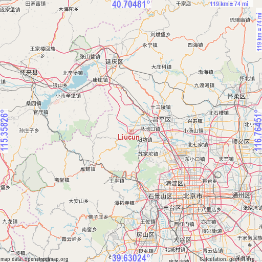
Liucun GPS coordinates[2]
40° 10' 10.74" North, 116° 3' 40.968" East
| Map corner | latitude | longitude |
|---|---|---|
| Upper-left | 40.70481°, | 115.35826° |
| Center: | 40.16965°, | 116.06138° |
| Lower-right: | 39.63024°, | 116.76451° |
| Map W x H: | 119.5×119.5 km | = 74.3×74.3mi |
| max Lat: | 53.31946° ⇑13% North |
| Liucun: | 40.16965° |
| min Lat: | ⇓87% South 18.22056° |
| min Long | Liucun | max Long |
| 75.07348° | 116.06138° | 134.28917° |
| W 60.4%⇐ | ⇒39.6% E |
Elevation
Elevation of Liucun is 127 m = 417 ft, and this is 357.8 m = 1174 ft below average elevation for this country.
| Max E: |
5622 m = 18445 ft | 55.6% |
| Avg. | 484.8 m = 1591 ft | |
| Liucun | 127 m = 417 ft | |
Min E: |
-3 m = -10 ft | 44.4% |
See also: China elevation on elevation.city.
Geographical zone
Liucun is located in North temperate zone (between Tropic of Cancer and the Arctic Circle). Distance of this Northern Tropic circle is 1860.5 km =1156.1 mi to South.| Distance of | km | miles | from Liucun |
|---|---|---|---|
| North Pole | 5540.6 | 3442.8 | to North |
| Arctic Circle | 2934.7 | 1823.5 | to North |
| Tropic Cancer | 1860.5 | 1156.1 | to South |
| Equator | 4466.4 | 2775.3 | to South |


Nearby cities:
15 places around Liucun: (largest is in red/bold)
• Changling
21.1 km =13.1 mi,  48°
48°
• Changping
15.6 km =9.7 mi,  70°
70°
• Chengbei
16.8 km =10.4 mi, 69°
• Chengnan
14.9 km =9.3 mi, 73°
• Junzhuang
18.9 km =11.7 mi,  171°
171°
• Machikou
8.6 km =5.3 mi,  80°
80°
• Miaofengshan
21.8 km =13.5 mi,  182°
182°
• Nankou
9.1 km =5.7 mi,  36°
36°
• Nanshao
19 km =11.8 mi, 77°
• Shahe
17.7 km =11 mi,  106°
106°
• Shisanling
17.9 km =11.1 mi, 51°
• Sujiatuo
13.2 km =8.2 mi,  141°
141°
• Wenquan
18 km =11.2 mi, 142°
• Xibeiwang
21.4 km =13.3 mi,  130°
130°
• Yangfang
6.7 km =4.2 mi,  121°
121°
Sources, notices
• [Note1] Compared only with cities in China existing in our database
• [Src1] Map data: © OpenStreetMap contributors (CC-BY-SA)
• [Src2] Other city data from geonames.org with taken over terms of usage.
• [Src3] Geographical zone / Annual Mean Temperature by Robert A. Rohde @ Wikipedia
