Yingshouyingzi geodata
Yingshouyingzi (Hebei) is a seat of a third-order administrative division; located in China in Asia/Shanghai (GMT+8) time zone. In our database, there are 1268 cities with bigger population. Compared to other cities in China, 88.2% of cities are located further ↓South; 69.3% of cities are located further ←West and 72.9% of cities have lower elevation than Yingshouyingzi. Note1


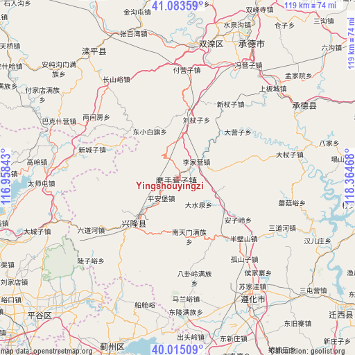
Yingshouyingzi GPS coordinates[2]
40° 33' 5.292" North, 117° 39' 41.58" East
| Map corner | latitude | longitude |
|---|---|---|
| Upper-left | 41.08359°, | 116.95843° |
| Center: | 40.55147°, | 117.66155° |
| Lower-right: | 40.01509°, | 118.36468° |
| Map W x H: | 118.8×118.8 km | = 73.8×73.8mi |
| max Lat: | 53.31946° ⇑11.8% North |
| Yingshouyingzi: | 40.55147° |
| min Lat: | ⇓88.2% South 18.22056° |
| min Long | Yingshouyingzi | max Long |
| 75.07348° | 117.66155° | 134.28917° |
| W 69.3%⇐ | ⇒30.7% E |
Elevation
Elevation of Yingshouyingzi is 473 m = 1552 ft, and this is 11.8 m = 39 ft below average elevation for this country.
| Max E: |
5622 m = 18445 ft | 27.1% |
| Avg. | 484.8 m = 1591 ft | |
| Yingshouyingzi | 473 m = 1552 ft | |
Min E: |
-3 m = -10 ft | 72.9% |
See also: China elevation on elevation.city.
Geographical zone
Yingshouyingzi is located in North temperate zone (between Tropic of Cancer and the Arctic Circle). Distance of this Northern Tropic circle is 1903 km =1182.5 mi to South.| Distance of | km | miles | from Yingshouyingzi |
|---|---|---|---|
| North Pole | 5498.2 | 3416.4 | to North |
| Arctic Circle | 2892.3 | 1797.2 | to North |
| Tropic Cancer | 1903 | 1182.5 | to South |
| Equator | 4508.9 | 2801.7 | to South |


Nearby cities:
15 places around Yingshouyingzi: (largest is in red/bold)
• Beizhuang
42 km =26.1 mi,  263°
263°
• Chengde
51.1 km =31.8 mi,  29°
29°
• Dachengzi
50.3 km =31.3 mi,  249°
249°
• Gaoling
47.4 km =29.5 mi,  276°
276°
• Gubeikou
45.2 km =28.1 mi,  289°
289°
• Jinhaihu
52.7 km =32.7 mi,  218°
218°
• Luanping
51.6 km =32.1 mi,  321°
321°
• Nandulehe
56.9 km =35.4 mi, 221°
• Shuangtashan
45.5 km =28.3 mi,  14°
14°
• Taishitun
45.9 km =28.5 mi,  268°
268°
• Xinchengzi
30.2 km =18.8 mi, 288°
• Xinglong
19.6 km =12.2 mi, 221°
• Xiong’erzhai
54.7 km =34 mi,  236°
236°
• Zhenluoying
50.4 km =31.3 mi, 242°
• Zunhua
48.4 km =30.1 mi,  148°
148°
Sources, notices
• [Note1] Compared only with cities in China existing in our database
• [Src1] Map data: © OpenStreetMap contributors (CC-BY-SA)
• [Src2] Other city data from geonames.org with taken over terms of usage.
• [Src3] Geographical zone / Annual Mean Temperature by Robert A. Rohde @ Wikipedia
