Longjiang geodata
Longjiang (Heilongjiang) is a seat of a third-order administrative division; located in China in Asia/Shanghai (GMT+8) time zone. With population of 106,384 people, there are 411 cities with bigger population in this country. Compared to other cities in China, 97.6% of cities are located further ↓South; 92.9% of cities are located further ←West and 52.5% of cities have lower elevation than Longjiang. Note1


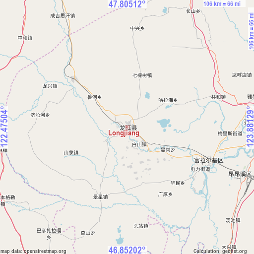
Longjiang GPS coordinates[2]
47° 19' 50.592" North, 123° 10' 41.376" East
| Map corner | latitude | longitude |
|---|---|---|
| Upper-left | 47.80512°, | 122.47504° |
| Center: | 47.33072°, | 123.17816° |
| Lower-right: | 46.85202°, | 123.88129° |
| Map W x H: | 106×106 km | = 65.9×65.9mi |
| max Lat: | 53.31946° ⇑2.4% North |
| Longjiang: | 47.33072° |
| min Lat: | ⇓97.6% South 18.22056° |
| min Long | Longjiang | max Long |
| 75.07348° | 123.17816° | 134.28917° |
| W 92.9%⇐ | ⇒7.1% E |
Elevation
Elevation of Longjiang is 184 m = 604 ft, and this is 300.8 m = 987 ft below average elevation for this country.
| Max E: |
5622 m = 18445 ft | 47.5% |
| Avg. | 484.8 m = 1591 ft | |
| Longjiang | 184 m = 604 ft | |
Min E: |
-3 m = -10 ft | 52.5% |
See also: Longjiang elevation on elevation.city.
Geographical zone
Longjiang is located in North temperate zone (between Tropic of Cancer and the Arctic Circle). Distance of this North polar circle is 2138.5 km =1328.8 mi to North.| Distance of | km | miles | from Longjiang |
|---|---|---|---|
| North Pole | 4744.4 | 2948 | to North |
| Arctic Circle | 2138.5 | 1328.8 | to North |
| Tropic Cancer | 2656.8 | 1650.9 | to South |
| Equator | 5262.7 | 3270.1 | to South |


Nearby cities:
15 places around Longjiang: (largest is in red/bold)
• Baishan
8.6 km =5.3 mi,  144°
144°
• Changqing
34.3 km =21.3 mi,  111°
111°
• Duibao
10.7 km =6.6 mi,  237°
237°
• Du’ermenqin
34.8 km =21.6 mi,  127°
127°
• Guanghou
32 km =19.9 mi,  150°
150°
• Halahai
20.1 km =12.5 mi,  56°
56°
• Hali
35.9 km =22.3 mi,  90°
90°
• Heigang
19 km =11.8 mi,  118°
118°
• Heshan
5 km =3.1 mi,  292°
292°
• Hong’an
36.5 km =22.7 mi, 112°
• Huamin
31 km =19.3 mi, 138°
• Jingxing
31.1 km =19.3 mi,  201°
201°
• Nianzishan
30.3 km =18.8 mi,  312°
312°
• Qikeshu
22.5 km =14 mi,  15°
15°
• Yongfa
22.1 km =13.7 mi,  207°
207°
Sources, notices
• [Note1] Compared only with cities in China existing in our database
• [Src1] Map data: © OpenStreetMap contributors (CC-BY-SA)
• [Src2] Other city data from geonames.org with taken over terms of usage.
• [Src3] Geographical zone / Annual Mean Temperature by Robert A. Rohde @ Wikipedia
