Kuandian geodata
Kuandian (Liaoning) is a populated place; located in China in Asia/Shanghai (GMT+8) time zone. With population of 70,867 people, there are 605 cities with bigger population in this country. Compared to other cities in China, 88.6% of cities are located further ↓South; 94.5% of cities are located further ←West and 61.9% of cities have lower elevation than Kuandian. Note1


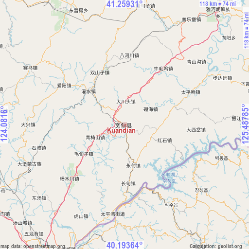
Kuandian GPS coordinates[2]
40° 43' 42.996" North, 124° 47' 4.992" East
| Map corner | latitude | longitude |
|---|---|---|
| Upper-left | 41.25931°, | 124.0816° |
| Center: | 40.72861°, | 124.78472° |
| Lower-right: | 40.19364°, | 125.48785° |
| Map W x H: | 118.5×118.5 km | = 73.6×73.6mi |
| max Lat: | 53.31946° ⇑11.4% North |
| Kuandian: | 40.72861° |
| min Lat: | ⇓88.6% South 18.22056° |
| min Long | Kuandian | max Long |
| 75.07348° | 124.78472° | 134.28917° |
| W 94.5%⇐ | ⇒5.5% E |
Elevation
Elevation of Kuandian is 281 m = 922 ft, and this is 203.8 m = 669 ft below average elevation for this country.
| Max E: |
5622 m = 18445 ft | 38.1% |
| Avg. | 484.8 m = 1591 ft | |
| Kuandian | 281 m = 922 ft | |
Min E: |
-3 m = -10 ft | 61.9% |
See also: Kuandian elevation on elevation.city.
Geographical zone
Kuandian is located in North temperate zone (between Tropic of Cancer and the Arctic Circle). Distance of this Northern Tropic circle is 1922.7 km =1194.7 mi to South.| Distance of | km | miles | from Kuandian |
|---|---|---|---|
| North Pole | 5478.5 | 3404.2 | to North |
| Arctic Circle | 2872.6 | 1785 | to North |
| Tropic Cancer | 1922.7 | 1194.7 | to South |
| Equator | 4528.6 | 2813.9 | to South |


Nearby cities:
15 places around Kuandian: (largest is in red/bold)
• Bahechuan
33.3 km =20.7 mi,  3°
3°
• Balidianzi
57.5 km =35.7 mi,  8°
8°
• Budayuan
51.5 km =32 mi,  63°
63°
• Caohezhang
73 km =45.4 mi,  301°
301°
• Dandong
74.4 km =46.2 mi,  206°
206°
• Dasiping
65.7 km =40.8 mi,  354°
354°
• Dongyingfang
58.9 km =36.6 mi,  338°
338°
• Fengcheng
67.5 km =41.9 mi,  243°
243°
• Jianchang
63.8 km =39.6 mi, 335°
• Liujiahe
68.2 km =42.4 mi,  264°
264°
• Muyuzi
74 km =46 mi, 11°
• Nandianzi
70.7 km =43.9 mi,  330°
330°
• Tianshifu
68.9 km =42.8 mi, 328°
• Tongyuanpu
73.5 km =45.7 mi,  275°
275°
• Zhenjiang
54.3 km =33.7 mi,  86°
86°
Sources, notices
• [Note1] Compared only with cities in China existing in our database
• [Src1] Map data: © OpenStreetMap contributors (CC-BY-SA)
• [Src2] Other city data from geonames.org with taken over terms of usage.
• [Src3] Geographical zone / Annual Mean Temperature by Robert A. Rohde @ Wikipedia
