Bahechuan geodata
Bahechuan (Liaoning) is a seat of a fourth-order administrative division; located in China in Asia/Shanghai (GMT+8) time zone. In our database, there are 1268 cities with bigger population. Compared to other cities in China, 89.3% of cities are located further ↓South; 94.5% of cities are located further ←West and 69% of cities have lower elevation than Bahechuan. Note1


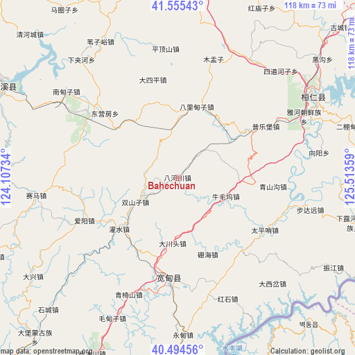
Bahechuan GPS coordinates[2]
41° 1' 37.668" North, 124° 48' 37.656" East
| Map corner | latitude | longitude |
|---|---|---|
| Upper-left | 41.55543°, | 124.10734° |
| Center: | 41.02713°, | 124.81046° |
| Lower-right: | 40.49456°, | 125.51359° |
| Map W x H: | 118×118 km | = 73.3×73.3mi |
| max Lat: | 53.31946° ⇑10.7% North |
| Bahechuan: | 41.02713° |
| min Lat: | ⇓89.3% South 18.22056° |
| min Long | Bahechuan | max Long |
| 75.07348° | 124.81046° | 134.28917° |
| W 94.5%⇐ | ⇒5.5% E |
Elevation
Elevation of Bahechuan is 393 m = 1289 ft, and this is 91.8 m = 301 ft below average elevation for this country.
| Max E: |
5622 m = 18445 ft | 31% |
| Avg. | 484.8 m = 1591 ft | |
| Bahechuan | 393 m = 1289 ft | |
Min E: |
-3 m = -10 ft | 69% |
See also: China elevation on elevation.city.
Geographical zone
Bahechuan is located in North temperate zone (between Tropic of Cancer and the Arctic Circle). Distance of this Northern Tropic circle is 1955.9 km =1215.3 mi to South.| Distance of | km | miles | from Bahechuan |
|---|---|---|---|
| North Pole | 5445.3 | 3383.6 | to North |
| Arctic Circle | 2839.4 | 1764.3 | to North |
| Tropic Cancer | 1955.9 | 1215.3 | to South |
| Equator | 4561.8 | 2834.6 | to South |


Nearby cities:
15 places around Bahechuan: (largest is in red/bold)
• Balidianzi
24.6 km =15.3 mi,  15°
15°
• Budayuan
45.1 km =28 mi,  103°
103°
• Caohezhang
64.7 km =40.2 mi,  274°
274°
• Dasiping
33.2 km =20.6 mi,  345°
345°
• Dongyingfang
32.2 km =20 mi,  311°
311°
• Huanren
53.5 km =33.2 mi,  60°
60°
• Jianchang
37.8 km =23.5 mi, 311°
• Kuandian
33.3 km =20.7 mi,  183°
183°
• Muyuzi
41.2 km =25.6 mi, 17°
• Nandianzi
46.5 km =28.9 mi, 307°
• Pingdingshan
43.1 km =26.8 mi, 354°
• Tianshifu
46 km =28.6 mi,  303°
303°
• Weiziyu
52.2 km =32.4 mi,  330°
330°
• Xiaoshi
65.1 km =40.5 mi, 297°
• Zhenjiang
60 km =37.3 mi,  120°
120°
Sources, notices
• [Note1] Compared only with cities in China existing in our database
• [Src1] Map data: © OpenStreetMap contributors (CC-BY-SA)
• [Src2] Other city data from geonames.org with taken over terms of usage.
• [Src3] Geographical zone / Annual Mean Temperature by Robert A. Rohde @ Wikipedia
