Minzhu geodata
Minzhu (Jilin) is a seat of a third-order administrative division; located in China in Asia/Shanghai (GMT+8) time zone. With population of 123,018 people, there are 359 cities with bigger population in this country. Compared to other cities in China, 92.5% of cities are located further ↓South; 97.3% of cities are located further ←West and 61.7% of cities have lower elevation than Minzhu. Note1


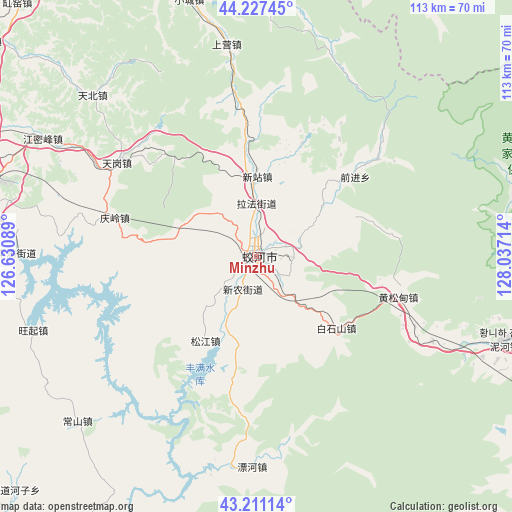
Minzhu GPS coordinates[2]
43° 43' 17.22" North, 127° 20' 2.436" East
| Map corner | latitude | longitude |
|---|---|---|
| Upper-left | 44.22745°, | 126.63089° |
| Center: | 43.72145°, | 127.33401° |
| Lower-right: | 43.21114°, | 128.03714° |
| Map W x H: | 113×113 km | = 70.2×70.2mi |
| max Lat: | 53.31946° ⇑7.5% North |
| Minzhu: | 43.72145° |
| min Lat: | ⇓92.5% South 18.22056° |
| min Long | Minzhu | max Long |
| 75.07348° | 127.33401° | 134.28917° |
| W 97.3%⇐ | ⇒2.7% E |
Elevation
Elevation of Minzhu is 279 m = 915 ft, and this is 205.8 m = 675 ft below average elevation for this country.
| Max E: |
5622 m = 18445 ft | 38.3% |
| Avg. | 484.8 m = 1591 ft | |
| Minzhu | 279 m = 915 ft | |
Min E: |
-3 m = -10 ft | 61.7% |
See also: Minzhu elevation on elevation.city.
Geographical zone
Minzhu is located in North temperate zone (between Tropic of Cancer and the Arctic Circle). Distance of this Northern Tropic circle is 2255.5 km =1401.5 mi to South.| Distance of | km | miles | from Minzhu |
|---|---|---|---|
| North Pole | 5145.7 | 3197.4 | to North |
| Arctic Circle | 2539.8 | 1578.2 | to North |
| Tropic Cancer | 2255.5 | 1401.5 | to South |
| Equator | 4861.4 | 3020.7 | to South |


Nearby cities:
15 places around Minzhu: (largest is in red/bold)
• Baishishan
24.2 km =15 mi,  129°
129°
• Dunhua
82.9 km =51.5 mi,  117°
117°
• Erdaodianzi
66.2 km =41.1 mi,  193°
193°
• Gongji
88.5 km =55 mi,  204°
204°
• Hongshi
87.1 km =54.1 mi, 192°
• Huangnihe
58.4 km =36.3 mi,  108°
108°
• Jilin
63.8 km =39.6 mi,  283°
283°
• Jishu
78.8 km =49 mi,  327°
327°
• Kouqian
71 km =44.1 mi,  262°
262°
• Laojinchang
90.5 km =56.2 mi,  178°
178°
• Qingsong
77.1 km =47.9 mi,  1°
1°
• Shahezi
82.9 km =51.5 mi,  15°
15°
• Shulan
83.2 km =51.7 mi,  338°
338°
• Xin’an
60.6 km =37.7 mi, 2°
• Yushugou
47.5 km =29.5 mi, 19°
Sources, notices
• [Note1] Compared only with cities in China existing in our database
• [Src1] Map data: © OpenStreetMap contributors (CC-BY-SA)
• [Src2] Other city data from geonames.org with taken over terms of usage.
• [Src3] Geographical zone / Annual Mean Temperature by Robert A. Rohde @ Wikipedia
