Dunhua geodata
Dunhua (Jilin) is a populated place; located in China in Asia/Shanghai (GMT+8) time zone. With population of 148,844 people, there are 299 cities with bigger population in this country. Compared to other cities in China, 92.2% of cities are located further ↓South; 98.1% of cities are located further ←West and 74% of cities have lower elevation than Dunhua. Note1


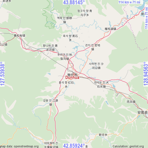
Dunhua GPS coordinates[2]
43° 22' 21" North, 128° 14' 33" East
| Map corner | latitude | longitude |
|---|---|---|
| Upper-left | 43.88145°, | 127.53938° |
| Center: | 43.3725°, | 128.2425° |
| Lower-right: | 42.85924°, | 128.94563° |
| Map W x H: | 113.7×113.7 km | = 70.6×70.6mi |
| max Lat: | 53.31946° ⇑7.8% North |
| Dunhua: | 43.3725° |
| min Lat: | ⇓92.2% South 18.22056° |
| min Long | Dunhua | max Long |
| 75.07348° | 128.2425° | 134.28917° |
| W 98.1%⇐ | ⇒1.9% E |
Elevation
Elevation of Dunhua is 501 m = 1644 ft, and this is 16.2 m = 53 ft above average elevation for this country.
| Max E: |
5622 m = 18445 ft | 26% |
| Dunhua | 501 m 1644 ft | |
| Avg. | 484.8 m = 1591 ft | |
Min E: |
-3 m = -10 ft | 74% |
See also: Dunhua elevation on elevation.city.
Geographical zone
Dunhua is located in North temperate zone (between Tropic of Cancer and the Arctic Circle). Distance of this Northern Tropic circle is 2216.7 km =1377.4 mi to South.| Distance of | km | miles | from Dunhua |
|---|---|---|---|
| North Pole | 5184.5 | 3221.5 | to North |
| Arctic Circle | 2578.6 | 1602.3 | to North |
| Tropic Cancer | 2216.7 | 1377.4 | to South |
| Equator | 4822.6 | 2996.6 | to South |


Nearby cities:
15 places around Dunhua: (largest is in red/bold)
• Baishishan
59.4 km =36.9 mi,  293°
293°
• Baishuitan
77 km =47.8 mi,  207°
207°
• Changxing
60.2 km =37.4 mi,  110°
110°
• Dadianzi
55.9 km =34.7 mi,  173°
173°
• Dapuchaihe
57.4 km =35.7 mi,  197°
197°
• Dashahe
72.3 km =44.9 mi,  179°
179°
• Dashitou
22.9 km =14.2 mi, 108°
• Dongjiang
81.3 km =50.5 mi,  188°
188°
• Huangnihe
27.2 km =16.9 mi,  319°
319°
• Liangbing
48.6 km =30.2 mi,  115°
115°
• Mingyue
62.4 km =38.8 mi, 118°
• Sandaowan
78.9 km =49 mi, 106°
• Shimen
73.2 km =45.5 mi, 121°
• Shiqi
51.7 km =32.1 mi,  153°
153°
• Xiaoshahe
81.6 km =50.7 mi, 177°
Sources, notices
• [Note1] Compared only with cities in China existing in our database
• [Src1] Map data: © OpenStreetMap contributors (CC-BY-SA)
• [Src2] Other city data from geonames.org with taken over terms of usage.
• [Src3] Geographical zone / Annual Mean Temperature by Robert A. Rohde @ Wikipedia
