Honggor geodata
Honggor (Inner Mongolia) is a seat of a fourth-order administrative division; located in China in Asia/Shanghai (GMT+8) time zone. In our database, there are 1268 cities with bigger population. Compared to other cities in China, 93.7% of cities are located further ↓South; 61.6% of cities are located further →East and 87% of cities have lower elevation than Honggor. Note1


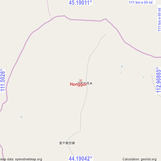
Honggor GPS coordinates[2]
44° 41' 32.712" North, 112° 12' 20.592" East
| Map corner | latitude | longitude |
|---|---|---|
| Upper-left | 45.19011°, | 111.5026° |
| Center: | 44.69242°, | 112.20572° |
| Lower-right: | 44.19042°, | 112.90885° |
| Map W x H: | 111.2×111.2 km | = 69.1×69.1mi |
| max Lat: | 53.31946° ⇑6.3% North |
| Honggor: | 44.69242° |
| min Lat: | ⇓93.7% South 18.22056° |
| min Long | Honggor | max Long |
| 75.07348° | 112.20572° | 134.28917° |
| W 38.4%⇐ | ⇒61.6% E |
Elevation
Elevation of Honggor is 1112 m = 3648 ft, and this is 627.2 m = 2058 ft above average elevation for this country.
| Max E: |
5622 m = 18445 ft | 13% |
| Honggor | 1112 m 3648 ft | |
| Avg. | 484.8 m = 1591 ft | |
Min E: |
-3 m = -10 ft | 87% |
See also: China elevation on elevation.city.
Geographical zone
Honggor is located in North temperate zone (between Tropic of Cancer and the Arctic Circle). Distance of this Northern Tropic circle is 2363.4 km =1468.5 mi to South.| Distance of | km | miles | from Honggor |
|---|---|---|---|
| North Pole | 5037.7 | 3130.3 | to North |
| Arctic Circle | 2431.8 | 1511 | to North |
| Tropic Cancer | 2363.4 | 1468.5 | to South |
| Equator | 4969.3 | 3087.8 | to South |


Nearby cities:
15 places around Honggor: (largest is in red/bold)
• Altan Hil
265.3 km =164.8 mi,  77°
77°
• Bahaodi
315.5 km =196 mi,  168°
168°
• Bayan Bulag
301.5 km =187.3 mi,  99°
99°
• Bayan Tug
194.4 km =120.8 mi, 82°
• Bieligutai
232.5 km =144.5 mi,  108°
108°
• Dalai
62.4 km =38.8 mi, 96°
• Erenhot
117.6 km =73.1 mi,  188°
188°
• Mandalt
153.1 km =95.1 mi,  128°
128°
• Naran Bulag
151.3 km =94 mi,  92°
92°
• Qagan Obo
61.7 km =38.3 mi,  216°
216°
• Saihan Tal
220.5 km =137 mi, 170°
• Sanjinquan
324.4 km =201.6 mi, 170°
• Xilin Hot
314.9 km =195.7 mi, 104°
• Xin Bulag
303 km =188.3 mi,  154°
154°
• Xiritala
318.6 km =198 mi, 105°
Sources, notices
• [Note1] Compared only with cities in China existing in our database
• [Src1] Map data: © OpenStreetMap contributors (CC-BY-SA)
• [Src2] Other city data from geonames.org with taken over terms of usage.
• [Src3] Geographical zone / Annual Mean Temperature by Robert A. Rohde @ Wikipedia
