Bayart Huxu geodata
Bayart Huxu (Inner Mongolia) is a seat of a fourth-order administrative division; located in China in Asia/Shanghai (GMT+8) time zone. In our database, there are 1268 cities with bigger population. Compared to other cities in China, 93.9% of cities are located further ↓South; 84.2% of cities are located further ←West and 78.5% of cities have lower elevation than Bayart Huxu. Note1


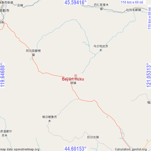
Bayart Huxu GPS coordinates[2]
45° 6' 0" North, 120° 21' 0" East
| Map corner | latitude | longitude |
|---|---|---|
| Upper-left | 45.59416°, | 119.64688° |
| Center: | 45.1°, | 120.35° |
| Lower-right: | 44.60153°, | 121.05313° |
| Map W x H: | 110.4×110.4 km | = 68.6×68.6mi |
| max Lat: | 53.31946° ⇑6.1% North |
| Bayart Huxu: | 45.1° |
| min Lat: | ⇓93.9% South 18.22056° |
| min Long | Bayart Huxu | max Long |
| 75.07348° | 120.35° | 134.28917° |
| W 84.2%⇐ | ⇒15.8% E |
Elevation
Elevation of Bayart Huxu is 631 m = 2070 ft, and this is 146.2 m = 480 ft above average elevation for this country.
| Max E: |
5622 m = 18445 ft | 21.5% |
| Bayart Huxu | 631 m 2070 ft | |
| Avg. | 484.8 m = 1591 ft | |
Min E: |
-3 m = -10 ft | 78.5% |
See also: China elevation on elevation.city.
Geographical zone
Bayart Huxu is located in North temperate zone (between Tropic of Cancer and the Arctic Circle). Distance of this North polar circle is 2386.5 km =1482.9 mi to North.| Distance of | km | miles | from Bayart Huxu |
|---|---|---|---|
| North Pole | 4992.4 | 3102.1 | to North |
| Arctic Circle | 2386.5 | 1482.9 | to North |
| Tropic Cancer | 2408.7 | 1496.7 | to South |
| Equator | 5014.6 | 3115.9 | to South |


Nearby cities:
15 places around Bayart Huxu: (largest is in red/bold)
• Baoshi
102 km =63.4 mi,  38°
38°
• Bayan Huxu
82.6 km =51.3 mi,  86°
86°
• Bayan Tal
78.2 km =48.6 mi,  174°
174°
• Burgastai
108 km =67.1 mi,  271°
271°
• Dolod
109.5 km =68 mi,  127°
127°
• Gaoliban
116.5 km =72.4 mi,  101°
101°
• Har Nur
63.3 km =39.3 mi,  340°
340°
• Holt
117.2 km =72.8 mi,  230°
230°
• Lubei
72.5 km =45 mi,  138°
138°
• Mositai
72.1 km =44.8 mi,  312°
312°
• Shuiquan
122.7 km =76.2 mi,  68°
68°
• Shumugou
123.7 km =76.9 mi,  16°
16°
• Tule Mod
64.3 km =40 mi, 38°
• Tuquan
103.8 km =64.5 mi, 71°
• Xuetian
95.4 km =59.3 mi,  48°
48°
Sources, notices
• [Note1] Compared only with cities in China existing in our database
• [Src1] Map data: © OpenStreetMap contributors (CC-BY-SA)
• [Src2] Other city data from geonames.org with taken over terms of usage.
• [Src3] Geographical zone / Annual Mean Temperature by Robert A. Rohde @ Wikipedia
