Bayan Huxu geodata
Bayan Huxu (Inner Mongolia) is a seat of a third-order administrative division; located in China in Asia/Shanghai (GMT+8) time zone. In our database, there are 1268 cities with bigger population. Compared to other cities in China, 94% of cities are located further ↓South; 89.6% of cities are located further ←West and 62.6% of cities have lower elevation than Bayan Huxu. Note1


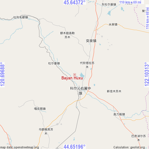
Bayan Huxu GPS coordinates[2]
45° 9' 0" North, 121° 24' 0" East
| Map corner | latitude | longitude |
|---|---|---|
| Upper-left | 45.64372°, | 120.69688° |
| Center: | 45.15°, | 121.4° |
| Lower-right: | 44.65196°, | 122.10313° |
| Map W x H: | 110.3×110.3 km | = 68.5×68.5mi |
| max Lat: | 53.31946° ⇑6% North |
| Bayan Huxu: | 45.15° |
| min Lat: | ⇓94% South 18.22056° |
| min Long | Bayan Huxu | max Long |
| 75.07348° | 121.4° | 134.28917° |
| W 89.6%⇐ | ⇒10.4% E |
Elevation
Elevation of Bayan Huxu is 291 m = 955 ft, and this is 193.8 m = 636 ft below average elevation for this country.
| Max E: |
5622 m = 18445 ft | 37.4% |
| Avg. | 484.8 m = 1591 ft | |
| Bayan Huxu | 291 m = 955 ft | |
Min E: |
-3 m = -10 ft | 62.6% |
See also: China elevation on elevation.city.
Geographical zone
Bayan Huxu is located in North temperate zone (between Tropic of Cancer and the Arctic Circle). Distance of this North polar circle is 2381 km =1479.5 mi to North.| Distance of | km | miles | from Bayan Huxu |
|---|---|---|---|
| North Pole | 4986.9 | 3098.7 | to North |
| Arctic Circle | 2381 | 1479.5 | to North |
| Tropic Cancer | 2414.3 | 1500.2 | to South |
| Equator | 5020.2 | 3119.4 | to South |


Nearby cities:
15 places around Bayan Huxu: (largest is in red/bold)
• Anding
94.1 km =58.5 mi,  88°
88°
• Baoshi
76.3 km =47.4 mi,  346°
346°
• Bayart Huxu
82.6 km =51.3 mi,  266°
266°
• Dolod
72.4 km =45 mi,  176°
176°
• Gaoliban
43.2 km =26.8 mi,  133°
133°
• Hulitu
96.1 km =59.7 mi,  22°
22°
• Lubei
69.6 km =43.2 mi,  210°
210°
• Meiyao
78.1 km =48.5 mi,  25°
25°
• Shuiquan
50.2 km =31.2 mi,  40°
40°
• Tule Mod
60.9 km =37.8 mi,  316°
316°
• Tuquan
32.4 km =20.1 mi, 29°
• Wafang
94.9 km =59 mi,  51°
51°
• Xianghai
75.7 km =47 mi,  99°
99°
• Xuetian
58.4 km =36.3 mi, 349°
• Yong’an
76.1 km =47.3 mi,  14°
14°
Sources, notices
• [Note1] Compared only with cities in China existing in our database
• [Src1] Map data: © OpenStreetMap contributors (CC-BY-SA)
• [Src2] Other city data from geonames.org with taken over terms of usage.
• [Src3] Geographical zone / Annual Mean Temperature by Robert A. Rohde @ Wikipedia
