Gaoliban geodata
Gaoliban (Inner Mongolia) is a seat of a fourth-order administrative division; located in China in Asia/Shanghai (GMT+8) time zone. In our database, there are 1268 cities with bigger population. Compared to other cities in China, 93.7% of cities are located further ↓South; 90.8% of cities are located further ←West and 54% of cities have lower elevation than Gaoliban. Note1


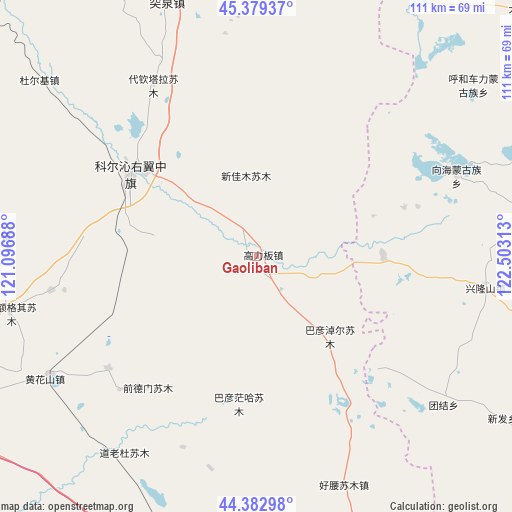
Gaoliban GPS coordinates[2]
44° 52' 59.988" North, 121° 48' 0" East
| Map corner | latitude | longitude |
|---|---|---|
| Upper-left | 45.37937°, | 121.09688° |
| Center: | 44.88333°, | 121.8° |
| Lower-right: | 44.38298°, | 122.50313° |
| Map W x H: | 110.8×110.8 km | = 68.8×68.8mi |
| max Lat: | 53.31946° ⇑6.3% North |
| Gaoliban: | 44.88333° |
| min Lat: | ⇓93.7% South 18.22056° |
| min Long | Gaoliban | max Long |
| 75.07348° | 121.8° | 134.28917° |
| W 90.8%⇐ | ⇒9.2% E |
Elevation
Elevation of Gaoliban is 197 m = 646 ft, and this is 287.8 m = 944 ft below average elevation for this country.
| Max E: |
5622 m = 18445 ft | 46% |
| Avg. | 484.8 m = 1591 ft | |
| Gaoliban | 197 m = 646 ft | |
Min E: |
-3 m = -10 ft | 54% |
See also: China elevation on elevation.city.
Geographical zone
Gaoliban is located in North temperate zone (between Tropic of Cancer and the Arctic Circle). Distance of this Northern Tropic circle is 2384.6 km =1481.7 mi to South.| Distance of | km | miles | from Gaoliban |
|---|---|---|---|
| North Pole | 5016.5 | 3117.1 | to North |
| Arctic Circle | 2410.6 | 1497.9 | to North |
| Tropic Cancer | 2384.6 | 1481.7 | to South |
| Equator | 4990.6 | 3101 | to South |


Nearby cities:
15 places around Gaoliban: (largest is in red/bold)
• Anding
70.3 km =43.7 mi,  63°
63°
• Bayan Huxu
43.2 km =26.8 mi,  313°
313°
• Bor Ondor
83.4 km =51.8 mi,  145°
145°
• Dolod
50.8 km =31.6 mi,  212°
212°
• Guangming
92 km =57.2 mi, 57°
• Heishui
87.3 km =54.2 mi,  66°
66°
• Jurh
76.7 km =47.7 mi,  187°
187°
• Lubei
73.3 km =45.5 mi,  245°
245°
• Shuanggang
91.8 km =57 mi, 74°
• Shuiquan
68.1 km =42.3 mi,  0°
0°
• Tuquan
59.8 km =37.2 mi,  345°
345°
• Xi Ail
78.8 km =49 mi,  88°
88°
• Xianghai
46.4 km =28.8 mi, 68°
• Xinfa
61.2 km =38 mi,  123°
123°
• Xinhua
90.6 km =56.3 mi,  111°
111°
Sources, notices
• [Note1] Compared only with cities in China existing in our database
• [Src1] Map data: © OpenStreetMap contributors (CC-BY-SA)
• [Src2] Other city data from geonames.org with taken over terms of usage.
• [Src3] Geographical zone / Annual Mean Temperature by Robert A. Rohde @ Wikipedia
