Weiziyu geodata
Weiziyu (Liaoning) is a seat of a fourth-order administrative division; located in China in Asia/Shanghai (GMT+8) time zone. In our database, there are 1268 cities with bigger population. Compared to other cities in China, 88% of cities are located further ↓South; 92.4% of cities are located further ←West and 55.1% of cities have higher elevation than Weiziyu. Note1


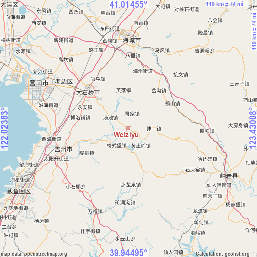
Weiziyu GPS coordinates[2]
40° 28' 54.768" North, 122° 43' 37.02" East
| Map corner | latitude | longitude |
|---|---|---|
| Upper-left | 41.01455°, | 122.02383° |
| Center: | 40.48188°, | 122.72695° |
| Lower-right: | 39.94495°, | 123.43008° |
| Map W x H: | 118.9×118.9 km | = 73.9×73.9mi |
| max Lat: | 53.31946° ⇑12% North |
| Weiziyu: | 40.48188° |
| min Lat: | ⇓88% South 18.22056° |
| min Long | Weiziyu | max Long |
| 75.07348° | 122.72695° | 134.28917° |
| W 92.4%⇐ | ⇒7.6% E |
Elevation
Elevation of Weiziyu is 131 m = 430 ft, and this is 353.8 m = 1161 ft below average elevation for this country.
| Max E: |
5622 m = 18445 ft | 55.1% |
| Avg. | 484.8 m = 1591 ft | |
| Weiziyu | 131 m = 430 ft | |
Min E: |
-3 m = -10 ft | 44.9% |
See also: China elevation on elevation.city.
Geographical zone
Weiziyu is located in North temperate zone (between Tropic of Cancer and the Arctic Circle). Distance of this Northern Tropic circle is 1895.2 km =1177.6 mi to South.| Distance of | km | miles | from Weiziyu |
|---|---|---|---|
| North Pole | 5505.9 | 3421.2 | to North |
| Arctic Circle | 2900 | 1802 | to North |
| Tropic Cancer | 1895.2 | 1177.6 | to South |
| Equator | 4501.2 | 2796.9 | to South |


Nearby cities:
15 places around Weiziyu: (largest is in red/bold)
• Bangshipu
9.3 km =5.8 mi,  216°
216°
• Boluopu
23.2 km =14.4 mi,  283°
283°
• Chagou
18.8 km =11.7 mi,  37°
37°
• Gaotun
11.8 km =7.3 mi,  243°
243°
• Gushan
23.2 km =14.4 mi,  60°
60°
• Huangtuling
9.4 km =5.8 mi,  144°
144°
• Jianyi
11.6 km =7.2 mi,  89°
89°
• Lüwang
15.4 km =9.6 mi,  126°
126°
• Nuanquan
22 km =13.7 mi, 239°
• Tangchi
10.3 km =6.4 mi,  301°
301°
• Tuandian
22.6 km =14 mi,  256°
256°
• Wolongquan
24.9 km =15.5 mi,  178°
178°
• Yingluo
18 km =11.2 mi,  352°
352°
• Yong’an
22.2 km =13.8 mi, 296°
• Zhoujia
7.1 km =4.4 mi,  12°
12°
Sources, notices
• [Note1] Compared only with cities in China existing in our database
• [Src1] Map data: © OpenStreetMap contributors (CC-BY-SA)
• [Src2] Other city data from geonames.org with taken over terms of usage.
• [Src3] Geographical zone / Annual Mean Temperature by Robert A. Rohde @ Wikipedia
