Tangxi geodata
Tangxi (Guangdong) is a seat of a fourth-order administrative division; located in China in Asia/Shanghai (GMT+8) time zone. In our database, there are 1268 cities with bigger population. Compared to other cities in China, 91.1% of cities are located further ↑North; 60.9% of cities are located further ←West and 83.4% of cities have higher elevation than Tangxi. Note1


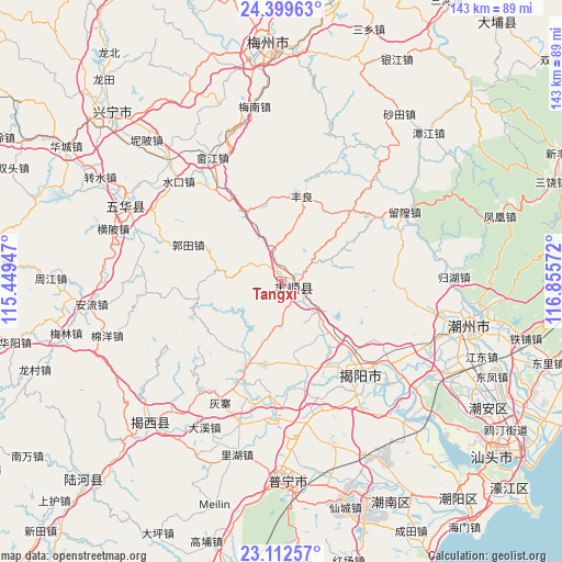
Tangxi GPS coordinates[2]
23° 45' 27.684" North, 116° 9' 9.324" East
| Map corner | latitude | longitude |
|---|---|---|
| Upper-left | 24.39963°, | 115.44947° |
| Center: | 23.75769°, | 116.15259° |
| Lower-right: | 23.11257°, | 116.85572° |
| Map W x H: | 143.1×143.1 km | = 88.9×88.9mi |
| max Lat: | 53.31946° ⇑91.1% North |
| Tangxi: | 23.75769° |
| min Lat: | ⇓8.9% South 18.22056° |
| min Long | Tangxi | max Long |
| 75.07348° | 116.15259° | 134.28917° |
| W 60.9%⇐ | ⇒39.1% E |
Elevation
Elevation of Tangxi is 19 m = 62 ft, and this is 465.8 m = 1528 ft below average elevation for this country.
| Max E: |
5622 m = 18445 ft | 83.4% |
| Avg. | 484.8 m = 1591 ft | |
| Tangxi | 19 m = 62 ft | |
Min E: |
-3 m = -10 ft | 16.6% |
See also: China elevation on elevation.city.
Geographical zone
Tangxi is located in North temperate zone (between Tropic of Cancer and the Arctic Circle). Distance of this Northern Tropic circle is 35.7 km =22.2 mi to South.| Distance of | km | miles | from Tangxi |
|---|---|---|---|
| North Pole | 7365.5 | 4576.7 | to North |
| Arctic Circle | 4759.6 | 2957.5 | to North |
| Tropic Cancer | 35.7 | 22.2 | to South |
| Equator | 2641.6 | 1641.4 | to South |


Nearby cities:
15 places around Tangxi: (largest is in red/bold)
• Baita
22.5 km =14 mi,  166°
166°
• Baxiangshan
18.4 km =11.4 mi,  273°
273°
• Beidou
7.5 km =4.7 mi,  343°
343°
• Buzhai
12 km =7.5 mi,  180°
180°
• Fengliang
22.2 km =13.8 mi,  13°
13°
• Guiling
20.8 km =12.9 mi,  155°
155°
• Guotian
24.3 km =15.1 mi,  290°
290°
• Linpan
24.1 km =15 mi, 159°
• Longwei
20.3 km =12.6 mi, 181°
• Tangkeng
1.9 km =1.2 mi,  85°
85°
• Tangnan
6.2 km =3.9 mi,  127°
127°
• Wujingfu
22.9 km =14.2 mi,  201°
201°
• Xichang
23.9 km =14.9 mi, 132°
• Xinheng
19 km =11.8 mi, 133°
• Yuhu
11.8 km =7.3 mi,  135°
135°
Sources, notices
• [Note1] Compared only with cities in China existing in our database
• [Src1] Map data: © OpenStreetMap contributors (CC-BY-SA)
• [Src2] Other city data from geonames.org with taken over terms of usage.
• [Src3] Geographical zone / Annual Mean Temperature by Robert A. Rohde @ Wikipedia
