Xiuma geodata
Xiuma (Qinghai) is a seat of a fourth-order administrative division; located in China in Asia/Shanghai (GMT+8) time zone. In our database, there are 1268 cities with bigger population. Compared to other cities in China, 75.1% of cities are located further ↓South; 94.3% of cities are located further →East and 97.3% of cities have lower elevation than Xiuma. Note1


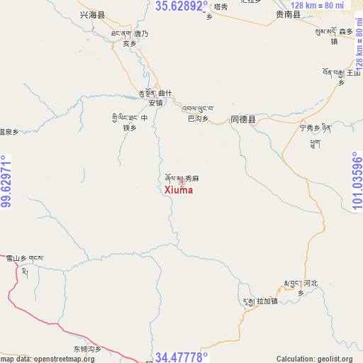
Xiuma GPS coordinates[2]
35° 3' 19.368" North, 100° 19' 58.188" East
| Map corner | latitude | longitude |
|---|---|---|
| Upper-left | 35.62892°, | 99.62971° |
| Center: | 35.05538°, | 100.33283° |
| Lower-right: | 34.47778°, | 101.03596° |
| Map W x H: | 128×128 km | = 79.5×79.5mi |
| max Lat: | 53.31946° ⇑24.9% North |
| Xiuma: | 35.05538° |
| min Lat: | ⇓75.1% South 18.22056° |
| min Long | Xiuma | max Long |
| 75.07348° | 100.33283° | 134.28917° |
| W 5.7%⇐ | ⇒94.3% E |
Elevation
Elevation of Xiuma is 3240 m = 10630 ft, and this is 2755.2 m = 9039 ft above average elevation for this country.
| Max E: |
5622 m = 18445 ft | 2.7% |
| Xiuma | 3240 m 10630 ft | |
| Avg. | 484.8 m = 1591 ft | |
Min E: |
-3 m = -10 ft | 97.3% |
See also: China elevation on elevation.city.
Geographical zone
Xiuma is located in North temperate zone (between Tropic of Cancer and the Arctic Circle). Distance of this Northern Tropic circle is 1291.9 km =802.7 mi to South.| Distance of | km | miles | from Xiuma |
|---|---|---|---|
| North Pole | 6109.3 | 3796.1 | to North |
| Arctic Circle | 3503.4 | 2176.9 | to North |
| Tropic Cancer | 1291.9 | 802.7 | to South |
| Equator | 3897.8 | 2422 | to South |


Nearby cities:
15 places around Xiuma: (largest is in red/bold)
• Bagou
24.9 km =15.5 mi,  13°
13°
• Dawu
63.4 km =39.4 mi,  189°
189°
• Gabasumdo
30 km =18.6 mi,  41°
41°
• Gomang
20.3 km =12.6 mi,  46°
46°
• Hor
62.6 km =38.9 mi,  71°
71°
• Longcang
34.5 km =21.4 mi,  316°
316°
• Nyinqug
50.3 km =31.3 mi, 70°
• Qushi’an
31.4 km =19.5 mi,  343°
343°
• Sangdang
59.4 km =36.9 mi,  330°
330°
• Tanggan
18 km =11.2 mi,  23°
23°
• Tangnaihai
54.2 km =33.7 mi, 340°
• Taxiu
61.1 km =38 mi, 9°
• Wenquan
63.5 km =39.5 mi,  286°
286°
• Xueshan
62.4 km =38.8 mi,  242°
242°
• Zhongtie
27.8 km =17.3 mi, 319°
Sources, notices
• [Note1] Compared only with cities in China existing in our database
• [Src1] Map data: © OpenStreetMap contributors (CC-BY-SA)
• [Src2] Other city data from geonames.org with taken over terms of usage.
• [Src3] Geographical zone / Annual Mean Temperature by Robert A. Rohde @ Wikipedia
