Xueshan geodata
Xueshan (Qinghai) is a seat of a fourth-order administrative division; located in China in Asia/Shanghai (GMT+8) time zone. In our database, there are 1268 cities with bigger population. Compared to other cities in China, 74.2% of cities are located further ↓South; 94.7% of cities are located further →East and 98% of cities have lower elevation than Xueshan. Note1


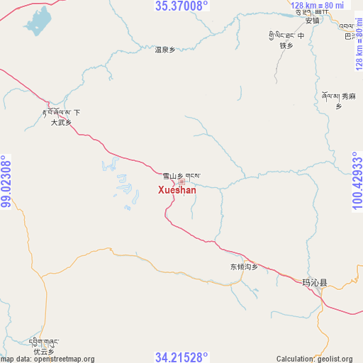
Xueshan GPS coordinates[2]
34° 47' 40.92" North, 99° 43' 34.32" East
| Map corner | latitude | longitude |
|---|---|---|
| Upper-left | 35.37008°, | 99.02308° |
| Center: | 34.7947°, | 99.7262° |
| Lower-right: | 34.21528°, | 100.42933° |
| Map W x H: | 128.4×128.4 km | = 79.8×79.8mi |
| max Lat: | 53.31946° ⇑25.8% North |
| Xueshan: | 34.7947° |
| min Lat: | ⇓74.2% South 18.22056° |
| min Long | Xueshan | max Long |
| 75.07348° | 99.7262° | 134.28917° |
| W 5.3%⇐ | ⇒94.7% E |
Elevation
Elevation of Xueshan is 3666 m = 12028 ft, and this is 3181.2 m = 10437 ft above average elevation for this country.
| Max E: |
5622 m = 18445 ft | 2% |
| Xueshan | 3666 m 12028 ft | |
| Avg. | 484.8 m = 1591 ft | |
Min E: |
-3 m = -10 ft | 98% |
See also: China elevation on elevation.city.
Geographical zone
Xueshan is located in North temperate zone (between Tropic of Cancer and the Arctic Circle). Distance of this Northern Tropic circle is 1262.9 km =784.7 mi to South.| Distance of | km | miles | from Xueshan |
|---|---|---|---|
| North Pole | 6138.3 | 3814.2 | to North |
| Arctic Circle | 3532.4 | 2194.9 | to North |
| Tropic Cancer | 1262.9 | 784.7 | to South |
| Equator | 3868.8 | 2404 | to South |


Nearby cities:
15 places around Xueshan: (largest is in red/bold)
• Bagou
81 km =50.3 mi,  48°
48°
• Changmahe
60.5 km =37.6 mi,  235°
235°
• Dawu
55.9 km =34.7 mi,  126°
126°
• Dawu
58.8 km =36.5 mi, 128°
• Dongqinggou
37.4 km =23.2 mi,  143°
143°
• Gomang
82.2 km =51.1 mi,  58°
58°
• Kyinzhi
83.5 km =51.9 mi,  149°
149°
• Longcang
62.4 km =38.8 mi,  30°
30°
• Qushi’an
74.9 km =46.5 mi,  37°
37°
• Tanggan
77.3 km =48 mi, 53°
• Wenquan
47.3 km =29.4 mi,  352°
352°
• Xia Dawo
48.4 km =30.1 mi,  298°
298°
• Xiuma
62.4 km =38.8 mi, 62°
• Youyun
76.1 km =47.3 mi,  220°
220°
• Zhongtie
62.3 km =38.7 mi, 36°
Sources, notices
• [Note1] Compared only with cities in China existing in our database
• [Src1] Map data: © OpenStreetMap contributors (CC-BY-SA)
• [Src2] Other city data from geonames.org with taken over terms of usage.
• [Src3] Geographical zone / Annual Mean Temperature by Robert A. Rohde @ Wikipedia
