Xiaoshi geodata
Xiaoshi (Liaoning) is a seat of a third-order administrative division; located in China in Asia/Shanghai (GMT+8) time zone. With population of 68,994 people, there are 620 cities with bigger population in this country. Compared to other cities in China, 89.8% of cities are located further ↓South; 93.9% of cities are located further ←West and 55% of cities have lower elevation than Xiaoshi. Note1


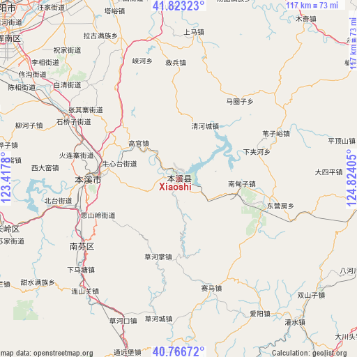
Xiaoshi GPS coordinates[2]
41° 17' 49.596" North, 124° 7' 15.312" East
| Map corner | latitude | longitude |
|---|---|---|
| Upper-left | 41.82323°, | 123.4178° |
| Center: | 41.29711°, | 124.12092° |
| Lower-right: | 40.76672°, | 124.82405° |
| Map W x H: | 117.5×117.5 km | = 73×73mi |
| max Lat: | 53.31946° ⇑10.2% North |
| Xiaoshi: | 41.29711° |
| min Lat: | ⇓89.8% South 18.22056° |
| min Long | Xiaoshi | max Long |
| 75.07348° | 124.12092° | 134.28917° |
| W 93.9%⇐ | ⇒6.1% E |
Elevation
Elevation of Xiaoshi is 206 m = 676 ft, and this is 278.8 m = 915 ft below average elevation for this country.
| Max E: |
5622 m = 18445 ft | 45% |
| Avg. | 484.8 m = 1591 ft | |
| Xiaoshi | 206 m = 676 ft | |
Min E: |
-3 m = -10 ft | 55% |
See also: Xiaoshi elevation on elevation.city.
Geographical zone
Xiaoshi is located in North temperate zone (between Tropic of Cancer and the Arctic Circle). Distance of this Northern Tropic circle is 1985.9 km =1234 mi to South.| Distance of | km | miles | from Xiaoshi |
|---|---|---|---|
| North Pole | 5415.3 | 3364.9 | to North |
| Arctic Circle | 2809.4 | 1745.7 | to North |
| Tropic Cancer | 1985.9 | 1234 | to South |
| Equator | 4591.8 | 2853.2 | to South |


Nearby cities:
15 places around Xiaoshi: (largest is in red/bold)
• Benxi
29.7 km =18.5 mi,  268°
268°
• Caohekou
49.9 km =31 mi,  201°
201°
• Caohezhang
26.4 km =16.4 mi,  194°
194°
• Dasiping
49.5 km =30.8 mi,  87°
87°
• Dongyingfang
34.7 km =21.6 mi,  104°
104°
• Guanyinge
1.9 km =1.2 mi,  343°
343°
• Hou’an
45.9 km =28.5 mi,  9°
9°
• Jianchang
29.7 km =18.5 mi, 99°
• Jiubing
38.4 km =23.9 mi,  358°
358°
• Majuanzi
32.8 km =20.4 mi,  39°
39°
• Nandianzi
20.9 km =13 mi, 94°
• Qinghecheng
19.6 km =12.2 mi,  26°
26°
• Shangma
53.9 km =33.5 mi,  2°
2°
• Tianshifu
19.9 km =12.4 mi, 103°
• Weiziyu
35.6 km =22.1 mi,  64°
64°
Sources, notices
• [Note1] Compared only with cities in China existing in our database
• [Src1] Map data: © OpenStreetMap contributors (CC-BY-SA)
• [Src2] Other city data from geonames.org with taken over terms of usage.
• [Src3] Geographical zone / Annual Mean Temperature by Robert A. Rohde @ Wikipedia
